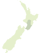
Map showing location of Te Whetū Kairangi Ridge
LINZ description: The main ridgeline of Te Motu Kairangi / Miramar Peninsula, extending north-south from Mount Crawford in the north to the high point above Worser Bay, on which is located a beaconed geodetic mark, coded 8117 and named “11 Seatoun”, at height 117m. NZTopo50-BQ31-Wellington, from: GR 531 269 to GR 527 242.
Latitude: -41.319167
Longitude: 174.824444
Northing: 5424205.9
Easting: 1752699.4
Land District: Wellington
Feat Type: Ridge
Latitude: -41.319167
Longitude: 174.824444
Northing: 5424205.9
Easting: 1752699.4
Land District: Wellington
Feat Type: Ridge
Scroll down to see a more detailed road map and below that a topographical map showing the location of Te Whetū Kairangi Ridge. The road map has been supplied by openstreetmap and the topographical map of Te Whetū Kairangi Ridge has been supplied by Land Information New Zealand (LINZ).
Yes you can use the top static map for you school/university project or personal website with a link back. Contact me for any commercial use.

[ A ] [ B ] [ C ] [ D ] [ E ] [ F ] [ G ] [ H ] [ I ] [ J ] [ K ] [ L ] [ M ] [ N ] [ O ] [ P ] [ Q ] [ R ] [ S ] [ T ] [ U ] [ V ] [ W ] [ X ] [ Y ] [ Z ]