Map showing location of Te Whatipu Rocks


LINZ description: Feature shown on: NZMS260 T12 Edition 3 1991 Limited Revision 1996
Latitude: -37.243222
Longitude: 175.899306
Northing: 5874205.8
Easting: 1857174.4
Land District: South Auckland
Feat Type: Island
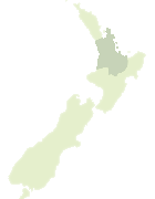

Scroll down to see a more detailed road map and below that a topographical map showing the location of Te Whatipu Rocks. The road map has been supplied by openstreetmap and the topographical map of Te Whatipu Rocks has been supplied by Land Information New Zealand (LINZ).

Yes you can use the top static map for you school/university project or personal website with a link back. Contact me for any commercial use.

Te Whatipu Rocks Map New Zealand


New Zealand places in our database
[ A ] [ B ] [ C ] [ D ] [ E ] [ F ] [ G ] [ H ] [ I ] [ J ] [ K ] [ L ] [ M ] [ N ] [ O ] [ P ] [ Q ] [ R ] [ S ] [ T ] [ U ] [ V ] [ W ] [ X ] [ Y ] [ Z ]


Closest 20 Islands to Te Whatipu Rocks

Te Teko Rocks ( 1.57km )   Rawengaiti Island ( 2.4km )   Whenuakura Island ( 2.65km )   Maukaha Rocks ( 2.84km )   Hauturu Island ( 3.4km )   Tokakahakaha Island ( 8.11km )   Papamaire Island ( 8.88km )   Hikunui Island ( 14.75km )   Motuhaua Rock ( 18.98km )   Rabbit Island ( 19.31km )   Penguin Island ( 19.87km )   Watchman Rock ( 21.71km )   Slipper Island (Whakahau) ( 22.02km )   Shoe Island (Motuhoa) ( 27.71km )   Motuahi Island ( 27.84km )   Mayor Island (Tuhua) ( 30.96km )   Tokopapa Island ( 32.94km )   Tawakewake Island (The Queen) ( 33.15km )   Motuoneone Island ( 33.8km )   Ruamahuaiti Island ( 33.94km )   Big Hump ( 34km )   Little Hump ( 34.17km )   Half Island ( 34.26km )   Egg Island ( 34.63km )   Nga Horo Island ( 34.63km )   Hongiora ( 34.93km )   The Aldermen Islands ( 34.95km )   Waipapa Island ( 34.98km )   Middle Island ( 35.58km )   Tutaetaka Island ( 35.88km )   Ruamahuanui Island ( 36.67km )   The Spire ( 36.82km )   Karewa Island ( 37.27km )   Matakana Island ( 41.29km )   Castle Island ( 41.67km )   Te Hopai Island ( 41.97km )   Tahunamanu Island ( 43.84km )   Motungaio Island ( 45.13km )   Motutangaroa Isle ( 45.53km )   Te Karaka Island ( 45.55km )