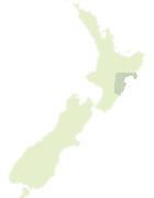
Map showing location of Te Waka-o-Ngārangikataka Ridge
LINZ description: A ridge on Te Waka Range extending from Te Waka northeast to contour line 880 m. NZTopo50-BJ38 157514 to 172531.
Latitude: -39.220799
Longitude: 176.664843
Northing: 5652317.4
Easting: 1916400.2
Land District: Hawke's Bay
Feat Type: Ridge
Latitude: -39.220799
Longitude: 176.664843
Northing: 5652317.4
Easting: 1916400.2
Land District: Hawke's Bay
Feat Type: Ridge
Scroll down to see a more detailed road map and below that a topographical map showing the location of Te Waka-o-Ngārangikataka Ridge. The road map has been supplied by openstreetmap and the topographical map of Te Waka-o-Ngārangikataka Ridge has been supplied by Land Information New Zealand (LINZ).
Yes you can use the top static map for you school/university project or personal website with a link back. Contact me for any commercial use.

[ A ] [ B ] [ C ] [ D ] [ E ] [ F ] [ G ] [ H ] [ I ] [ J ] [ K ] [ L ] [ M ] [ N ] [ O ] [ P ] [ Q ] [ R ] [ S ] [ T ] [ U ] [ V ] [ W ] [ X ] [ Y ] [ Z ]