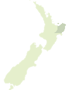
Map showing location of Te Tapuwae o Rongokako Marine Reserve
LINZ description: It sits below a Ngati Konohi pa (village) and was one of the main sources of food for the people who lived there. In 1999 the hapu (sub-tribe) joined with the Department of Conservation to create the marine reserve, as a way of giving back to Tangaroa (the god of the sea) in return for his generosity over previous generations.
The reserve is 16 km of good road north of Gisborne. It can be reached via State Highway 35, with public access at Pouawa
Latitude: -38.605556
Longitude: 178.219722
Northing: 5714052.7
Easting: 2054623.8
Land District: Gisborne
Feat Type: Marine Reserve
Latitude: -38.605556
Longitude: 178.219722
Northing: 5714052.7
Easting: 2054623.8
Land District: Gisborne
Feat Type: Marine Reserve

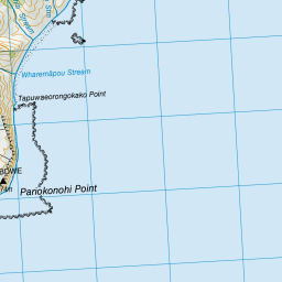
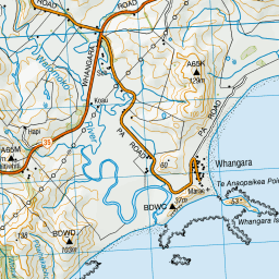
Scroll down to see a more detailed road map and below that a topographical map showing the location of Te Tapuwae o Rongokako Marine Reserve. The road map has been supplied by openstreetmap and the topographical map of Te Tapuwae o Rongokako Marine Reserve has been supplied by Land Information New Zealand (LINZ).
Yes you can use the top static map for you school/university project or personal website with a link back. Contact me for any commercial use.

Leaflet | Map data © OpenStreetMap contributors


Leaflet | Sourced from LINZ. CC BY 4.0
[ A ] [ B ] [ C ] [ D ] [ E ] [ F ] [ G ] [ H ] [ I ] [ J ] [ K ] [ L ] [ M ] [ N ] [ O ] [ P ] [ Q ] [ R ] [ S ] [ T ] [ U ] [ V ] [ W ] [ X ] [ Y ] [ Z ]


