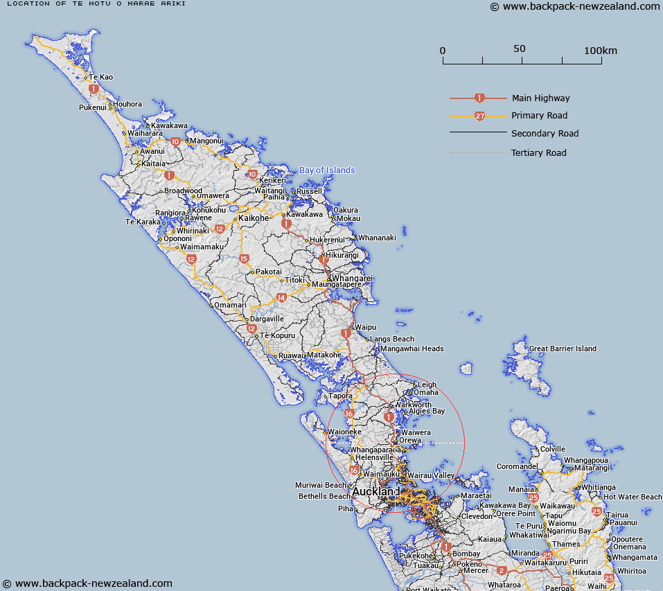
Map showing location of Te Motu-o-Marae-Ariki


LINZ description: An island located in the tidal estuary of the Orewa River approximately 1 km southwest of Orewa. NZTopo50 AZ31, GR 512 484. Feature shown on: NZMS260 R10
Latitude: -36.597583
Longitude: 174.690472
Northing: 5948437.4
Easting: 1751206.9
Land District: North Auckland
Feat Type: Island


Scroll down to see a more detailed road map and below that a topographical map showing the location of Te Motu-o-Marae-Ariki. The road map has been supplied by openstreetmap and the topographical map of Te Motu-o-Marae-Ariki has been supplied by Land Information New Zealand (LINZ).

Yes you can use the top static map for you school/university project or personal website with a link back. Contact me for any commercial use.
Te Motu-o-Marae-Ariki Map New Zealand


New Zealand places in our database
[ A ] [ B ] [ C ] [ D ] [ E ] [ F ] [ G ] [ H ] [ I ] [ J ] [ K ] [ L ] [ M ] [ N ] [ O ] [ P ] [ Q ] [ R ] [ S ] [ T ] [ U ] [ V ] [ W ] [ X ] [ Y ] [ Z ]


Closest 20 Islands to Te Motu-o-Marae-Ariki

Mahurangi Island ( 6.36km )   Brazier Rock ( 8.28km )   Kotanui Island (Frenchmans Cap) ( 8.86km )   Pudding Island ( 9.99km )   Te Haupa Island ( 10.74km )   Casnell Island ( 12.34km )   The Tor ( 13.11km )   Motuora Island ( 14.3km )   Grants Island ( 15.28km )   Moturekareka Island ( 16.08km )   Rocky Islets ( 16.09km )   Motutara Island ( 16.27km )   Wooded Island ( 17.32km )   Motuketekete Island ( 17.79km )   Tiritiri Matangi Island ( 18.29km )   Shag Rock ( 19.25km )   Beehive Island (Taungamaro Island) ( 19.97km )   Herald Island ( 20.48km )   Pine Island ( 20.48km )   Martello Rock (Ruakoura) ( 20.76km )   Archway Island ( 20.88km )   Takangaroa Island ( 21.29km )   Goat Island ( 21.29km )   Mayne Islands ( 21.35km )   Twins ( 21.66km )   Rabbit Island ( 22.27km )   Challenger Island (Little Kawau Island) ( 22.87km )   Little Markham Island ( 23.33km )   Pembles Island (Tangaroa) ( 24.35km )   Kawau Island ( 24.93km )   Woody Island ( 25.79km )   Orarapa Island (The Haystack) ( 26.01km )   Three Sisters ( 26.15km )   Ng? Tuaitara-a-Taikehu ( 26.38km )   Rangitoto Island ( 26.38km )   Te Rangi-i-Totongia-a-Tamatekapua ( 26.38km )   Motuhoropapa Island ( 26.52km )   Motuhurakia Island ( 26.52km )   Rakino Island ( 26.56km )   Slip Island ( 26.61km )