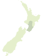
Map showing location of Taupō Point
LINZ description: A coastal point between Plimmerton Beach and Karehana Bay (bay) approximately 6 km north-northeast of Porirua City. NZTopo50-BP32 564503.
Latitude: -41.083416
Longitude: 174.862703
Northing: 5450311.2
Easting: 1756462.3
Land District: Wellington
Feat Type: Point
Latitude: -41.083416
Longitude: 174.862703
Northing: 5450311.2
Easting: 1756462.3
Land District: Wellington
Feat Type: Point
Scroll down to see a more detailed road map and below that a topographical map showing the location of Taupō Point. The road map has been supplied by openstreetmap and the topographical map of Taupō Point has been supplied by Land Information New Zealand (LINZ).
Yes you can use the top static map for you school/university project or personal website with a link back. Contact me for any commercial use.

[ A ] [ B ] [ C ] [ D ] [ E ] [ F ] [ G ] [ H ] [ I ] [ J ] [ K ] [ L ] [ M ] [ N ] [ O ] [ P ] [ Q ] [ R ] [ S ] [ T ] [ U ] [ V ] [ W ] [ X ] [ Y ] [ Z ]