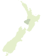
Map showing location of Tārere Forest
LINZ description: Feature shown on: NZTopo50-BK30 300195, BK31 330191, BJ30 289225
Latitude: -39.564262
Longitude: 174.5143
Northing: 5619508.6
Easting: 1730081
Land District: Taranaki
Feat Type: Forest
Latitude: -39.564262
Longitude: 174.5143
Northing: 5619508.6
Easting: 1730081
Land District: Taranaki
Feat Type: Forest
Scroll down to see a more detailed road map and below that a topographical map showing the location of Tārere Forest. The road map has been supplied by openstreetmap and the topographical map of Tārere Forest has been supplied by Land Information New Zealand (LINZ).
Yes you can use the top static map for you school/university project or personal website with a link back. Contact me for any commercial use.

[ A ] [ B ] [ C ] [ D ] [ E ] [ F ] [ G ] [ H ] [ I ] [ J ] [ K ] [ L ] [ M ] [ N ] [ O ] [ P ] [ Q ] [ R ] [ S ] [ T ] [ U ] [ V ] [ W ] [ X ] [ Y ] [ Z ]