Map showing location of Park Reef


LINZ description: Off the northern coast of White Island, Bay of Plenty
Latitude: -37.509506
Longitude: 177.177097
Northing: 5840400
Easting: 1969252.3
Land District: South Auckland
Feat Type: Reef
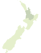

Scroll down to see a more detailed road map and below that a topographical map showing the location of Park Reef. The road map has been supplied by openstreetmap and the topographical map of Park Reef has been supplied by Land Information New Zealand (LINZ).

Yes you can use the top static map for you school/university project or personal website with a link back. Contact me for any commercial use.

Park Reef Map New Zealand


New Zealand places in our database
[ A ] [ B ] [ C ] [ D ] [ E ] [ F ] [ G ] [ H ] [ I ] [ J ] [ K ] [ L ] [ M ] [ N ] [ O ] [ P ] [ Q ] [ R ] [ S ] [ T ] [ U ] [ V ] [ W ] [ X ] [ Y ] [ Z ]


Closest 20 Reefs to Park Reef

Waiotahe Rock ( 50.48km )   Waiotahi Rock ( 50.48km )   ?kura Rock ( 65.74km )   Astrolabe Reef ( 66.2km )   Okaparu Reef ( 72.03km )   Pudney Rock ( 75.78km )   Tuhua Reef ( 81.65km )   Eclipse Rock ( 118.97km )   Roller Patch ( 122.6km )   Blind Rock ( 122.74km )   South Sunk Rock ( 142.82km )   Tokomaru Rock ( 149.6km )   The Foul Grounds ( 149.78km )   Pandora Rock ( 149.84km )   Hawea Rock ( 149.95km )   Gable Rocks ( 150.07km )   Temoana Rock ( 150.22km )   Waihora Rocks ( 152.21km )   Monowai Rocks ( 154.16km )   Tuaheni Rocks ( 156.84km )   Penguin Rock ( 164.64km )   Ariel Rocks ( 167.29km )   Esk Reef ( 173.08km )   Tokaanu Reef ( 173.35km )   Tawhiti Rock ( 174.86km )   Kawetoto Reef ( 178.58km )   Titokarua Reef ( 180.78km )   Scully Reef ( 189km )   Sunday Rock ( 193.74km )   Black Reef ( 200.91km )   Amodeo Rocks ( 202.15km )   Zeno Rock ( 213.19km )   T?kapu Rock ( 214.41km )   P?nia Rock ( 216.06km )   P?nia Reef ( 216.59km )   Iliomama Rock ( 217.38km )   Anchorite Rock ( 217.81km )   Aotea Reef ( 218.69km )   East Bastion Reef ( 218.84km )   Jacksons Reef ( 219.27km )