Map showing location of Paddys Creek


LINZ description: Feature shown on: NZMS260 F41 Edition 1 1991 Limited Revision 1996
Latitude: -44.86808
Longitude: 169.046157
Northing: 5024095.2
Easting: 1287661.1
Land District: Otago
Feat Type: Stream


Scroll down to see a more detailed road map and below that a topographical map showing the location of Paddys Creek. The road map has been supplied by openstreetmap and the topographical map of Paddys Creek has been supplied by Land Information New Zealand (LINZ).

Yes you can use the top static map for you school/university project or personal website with a link back. Contact me for any commercial use.
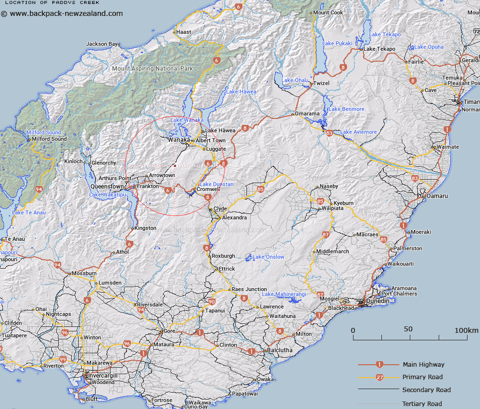
Paddys Creek Map New Zealand


New Zealand places in our database
[ A ] [ B ] [ C ] [ D ] [ E ] [ F ] [ G ] [ H ] [ I ] [ J ] [ K ] [ L ] [ M ] [ N ] [ O ] [ P ] [ Q ] [ R ] [ S ] [ T ] [ U ] [ V ] [ W ] [ X ] [ Y ] [ Z ]


Closest 20 Streams to Paddys Creek

Toms Creek ( 0.19km )   Welshes Creek ( 1.61km )   Roaring Meg ( 3.47km )   Boundary Creek ( 3.49km )   Storm Burn ( 3.65km )   Cardrona Company Water Race ( 3.74km )   Littles Water Race ( 3.85km )   Pongs Creek ( 4.13km )   Pringles Creek ( 5.08km )   Little Meg ( 5.36km )   Stony Creek ( 5.83km )   Deep Creek ( 5.97km )   Leopold Burn ( 6.13km )   Colour Burn ( 6.14km )   Callaghans Creek ( 6.41km )   Coes Gully Creek Left Branch ( 6.41km )   Macdonalds Creek ( 6.42km )   Winter Creek ( 6.64km )   Prince Burn ( 7.28km )   Branch Burn ( 7.32km )   Coes Gully Creek Right Branch ( 7.36km )   Back Creek ( 7.49km )   Blackmans Creek ( 8.66km )   Cliff Burn ( 8.91km )   Gills Creek ( 9.26km )   Mitre Creek ( 9.29km )   Plank Creek ( 9.39km )   Princess Burn ( 10.04km )   Adams Creek ( 10.12km )   Skeleton Stream ( 10.59km )   Evan Roberts Creek ( 11.74km )   Deaf Bills Creek ( 11.78km )   Coal Creek ( 11.84km )   Soho Creek ( 12.05km )   Spotts Creek ( 12.28km )   Alice Burn ( 12.36km )   Billy Creek ( 12.64km )   Golspie Burn ( 12.67km )   Roaring Meg or Kirtle Burn ( 12.8km )   Cardrona River ( 13.17km )