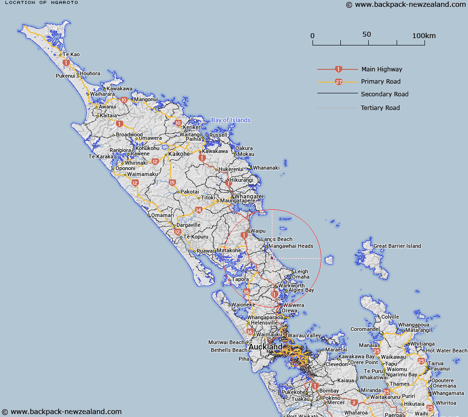
Map showing location of Ngāroto
LINZ description: An area which covers three small lakes – Slipper Lake, Spectacle Lake and Tomarata Lake. Located adjacent to Mangawhai Forest and approximately 15km north-east of Wellsford. NZTopo50 AY31, GR 470 942. Ngāroto does not replace the current recorded geographic names of the three lakes.
Latitude: -36.185846
Longitude: 174.634678
Northing: 5994200
Easting: 1746989.3
Land District: North Auckland
Feat Type: Site
Latitude: -36.185846
Longitude: 174.634678
Northing: 5994200
Easting: 1746989.3
Land District: North Auckland
Feat Type: Site
Scroll down to see a more detailed road map and below that a topographical map showing the location of Ngāroto. The road map has been supplied by openstreetmap and the topographical map of Ngāroto has been supplied by Land Information New Zealand (LINZ).
Yes you can use the top static map for you school/university project or personal website with a link back. Contact me for any commercial use.
[ A ] [ B ] [ C ] [ D ] [ E ] [ F ] [ G ] [ H ] [ I ] [ J ] [ K ] [ L ] [ M ] [ N ] [ O ] [ P ] [ Q ] [ R ] [ S ] [ T ] [ U ] [ V ] [ W ] [ X ] [ Y ] [ Z ]