Map showing location of Mullochy Stream


LINZ description: Feature shown on: NZMS260 L29 Edition 2 1996
Latitude: -41.67375
Longitude: 171.978583
Northing: 5385942
Easting: 1514977.5
Land District: Nelson
Feat Type: Stream


Scroll down to see a more detailed road map and below that a topographical map showing the location of Mullochy Stream. The road map has been supplied by openstreetmap and the topographical map of Mullochy Stream has been supplied by Land Information New Zealand (LINZ).

Yes you can use the top static map for you school/university project or personal website with a link back. Contact me for any commercial use.
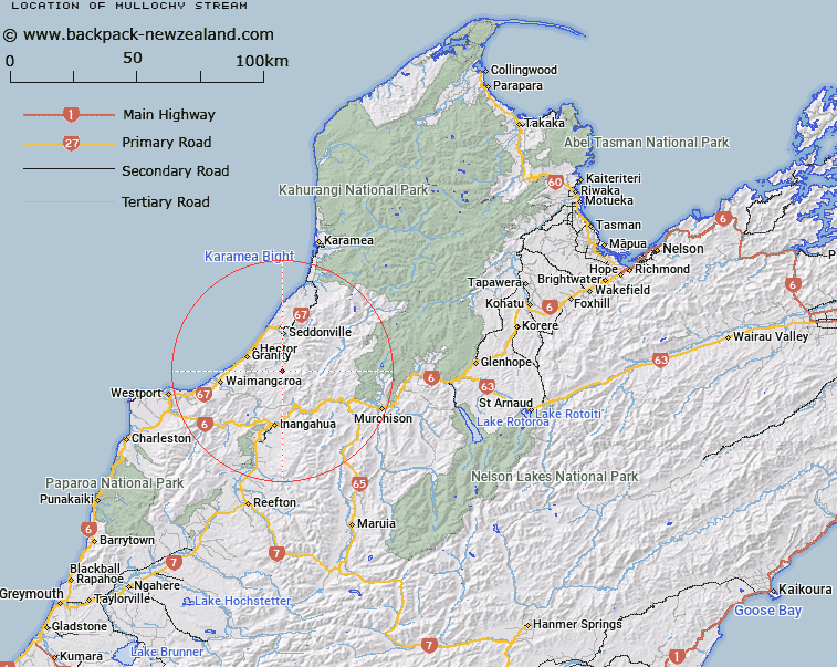
Mullochy Stream Map New Zealand


New Zealand places in our database
[ A ] [ B ] [ C ] [ D ] [ E ] [ F ] [ G ] [ H ] [ I ] [ J ] [ K ] [ L ] [ M ] [ N ] [ O ] [ P ] [ Q ] [ R ] [ S ] [ T ] [ U ] [ V ] [ W ] [ X ] [ Y ] [ Z ]


Closest 20 Streams to Mullochy Stream

Blackburn Stream ( 0.9km )   Saint Patrick Stream ( 2.79km )   Erin Stream ( 2.79km )   Blackburn Pakihi ( 3.01km )   Toddy Creek ( 3.34km )   Election Stream ( 3.76km )   Budge Creek ( 4.48km )   Munro Stream ( 4.58km )   Mossy Stream ( 4.61km )   Darcy Stream ( 4.68km )   Saint George Stream ( 4.78km )   Saint David Stream ( 5.25km )   T35 Stream ( 5.89km )   A.J. Stream ( 6.12km )   Mangatini Stream ( 6.52km )   Ngakawau River ( 6.53km )   Repo Stream ( 6.72km )   T31 Stream ( 6.74km )   Saint Andrew Stream ( 7.08km )   Pikopiko Stream ( 7.16km )   Tiger Pakihi ( 7.31km )   Tiger Stream ( 7.55km )   Weka Creek ( 7.63km )   Fly Creek ( 7.71km )   Sandy Creek ( 7.82km )   Plover Stream ( 7.99km )   Ford Creek ( 8.05km )   Rodger Creek ( 8.59km )   Tate Creek ( 8.62km )   Watson Stream ( 8.7km )   Rome Stream ( 8.76km )   Archer Stream ( 8.82km )   Cypress Stream ( 9.12km )   Tichborne Creek ( 9.21km )   Fletcher Stream ( 9.31km )   Dooley Stream ( 9.35km )   Whirlwind Stream ( 9.57km )   Plateau Stream ( 9.58km )   Muir Stream ( 9.59km )   Mishap Stream ( 9.6km )