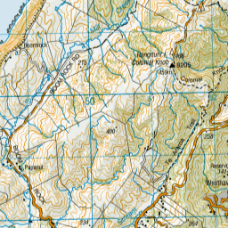
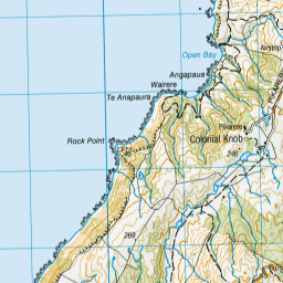
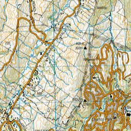
Map showing location of Mitchell Stream


LINZ description: Stream at Porirua with headwaters at Colonial Knob
Latitude: -41.153532
Longitude: 174.822569
Northing: 5442598.2
Easting: 1752928.1
Land District: Wellington
Feat Type: Stream


Scroll down to see a more detailed road map and below that a topographical map showing the location of Mitchell Stream. The road map has been supplied by openstreetmap and the topographical map of Mitchell Stream has been supplied by Land Information New Zealand (LINZ).

Yes you can use the top static map for you school/university project or personal website with a link back. Contact me for any commercial use.

Mitchell Stream Map New Zealand


New Zealand places in our database
[ A ] [ B ] [ C ] [ D ] [ E ] [ F ] [ G ] [ H ] [ I ] [ J ] [ K ] [ L ] [ M ] [ N ] [ O ] [ P ] [ Q ] [ R ] [ S ] [ T ] [ U ] [ V ] [ W ] [ X ] [ Y ] [ Z ]


Closest 20 Streams to Mitchell Stream

Takapuwahia Stream ( 1.67km )   Mill Creek ( 2.36km )   Takapu Stream ( 3.09km )   Cannons Creek ( 4km )   Kenepuru Stream ( 4.11km )   Porirua Stream ( 5.36km )   Duck Creek ( 6.2km )   Korokoro Stream ( 6.39km )   Korokoro Stream Track ( 6.74km )   Mill Creek ( 7.44km )   Speedys Stream ( 9.33km )   Pahautanui Stream ( 9.68km )   Pauatahanui Stream ( 9.68km )   Ohariu Stream ( 9.83km )   Taupo Stream ( 10.12km )   Waitohi Stream ( 10.55km )   Ngahauranga Stream ( 10.55km )   Ngauranga Stream ( 10.55km )   Waiwhetu Stream ( 11.54km )   Korimako Stream ( 12.12km )   Kaiwarawara Stream ( 12.17km )   Kaiwhara Stream ( 12.17km )   Kaiwara Stream ( 12.17km )   Kaiwharawhara Stream ( 12.17km )   Makara Stream ( 12.82km )   Wainuiomataiti Stream ( 14.78km )   North Makara Stream ( 14.88km )   Opau Stream ( 15.26km )   Crowthers Creek ( 15.62km )   Mawaihakona Stream ( 15.8km )   Horokiwi Stream ( 15.95km )   Horokiri Stream ( 15.95km )   Skull Gully Stream ( 17.17km )   Wainui Stream ( 17.61km )   Wainuiomata Stream ( 17.64km )   Butterfly Creek ( 17.74km )   Nikau Creek ( 19.07km )   Whakatikei River ( 19.11km )   Sledge Track Creek ( 19.13km )   Mangaroa River ( 19.15km )