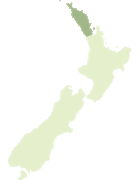
Map showing location of Lake Ngākeketo Recreation Reserve
LINZ description: The Crown stratum (the water and air column only) above the bed of Lake Ngakeketa, as defined in section 40 of Te Aupouri Claims Settlement Act 2015. NZTopo50-AT24 791804.
Latitude: -34.518206
Longitude: 172.772242
Northing: 6180360.3
Easting: 1579095.6
Land District: North Auckland
Feat Type: Recreation Reserve
Latitude: -34.518206
Longitude: 172.772242
Northing: 6180360.3
Easting: 1579095.6
Land District: North Auckland
Feat Type: Recreation Reserve
Scroll down to see a more detailed road map and below that a topographical map showing the location of Lake Ngākeketo Recreation Reserve. The road map has been supplied by openstreetmap and the topographical map of Lake Ngākeketo Recreation Reserve has been supplied by Land Information New Zealand (LINZ).
Yes you can use the top static map for you school/university project or personal website with a link back. Contact me for any commercial use.

[ A ] [ B ] [ C ] [ D ] [ E ] [ F ] [ G ] [ H ] [ I ] [ J ] [ K ] [ L ] [ M ] [ N ] [ O ] [ P ] [ Q ] [ R ] [ S ] [ T ] [ U ] [ V ] [ W ] [ X ] [ Y ] [ Z ]