Map showing location of Dog Creek


LINZ description: Feature shown on: NZMS260 P28 Edition 2 1985 Limited Revision 1997
Latitude: -41.610583
Longitude: 173.907972
Northing: 5393060.7
Easting: 1675653.2
Land District: Marlborough
Feat Type: Stream
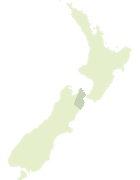

Scroll down to see a more detailed road map and below that a topographical map showing the location of Dog Creek. The road map has been supplied by openstreetmap and the topographical map of Dog Creek has been supplied by Land Information New Zealand (LINZ).

Yes you can use the top static map for you school/university project or personal website with a link back. Contact me for any commercial use.

Dog Creek Map New Zealand


New Zealand places in our database
[ A ] [ B ] [ C ] [ D ] [ E ] [ F ] [ G ] [ H ] [ I ] [ J ] [ K ] [ L ] [ M ] [ N ] [ O ] [ P ] [ Q ] [ R ] [ S ] [ T ] [ U ] [ V ] [ W ] [ X ] [ Y ] [ Z ]


Closest 20 Streams to Dog Creek

Branch River ( 3.15km )   Maxwell Stream ( 6.91km )   Donalds Creek ( 7.19km )   Omaka River ( 7.31km )   Taylor River ( 7.31km )   Fairhall River ( 7.32km )   Boundary Creek ( 7.64km )   Wards Stream ( 7.97km )   Grey Mare Stream ( 8.06km )   Nina Brook ( 8.18km )   Blairich River ( 8.25km )   Doctors Creek ( 8.75km )   Troloves Stream ( 9.25km )   Seventeen Valley Stream ( 9.4km )   Kennel Brook ( 9.41km )   Jacks Stream ( 10.21km )   Glen Craig Stream ( 10.41km )   Yelverton Stream ( 10.59km )   Mill Stream ( 10.95km )   Stafford Creek ( 11.05km )   Pukapuka Stream ( 11.6km )   Sams Creek ( 11.66km )   Riverlands Co-op Drain ( 11.93km )   Black Birch Stream ( 12.27km )   Utawai Creek ( 12.31km )   Omaka River ( 13.45km )   Starborough Creek ( 13.58km )   Roses Overflow ( 13.78km )   Maori Channel ( 13.9km )   ?paoa River ( 14.12km )   Opawa River ( 14.12km )   Ruakanakana Creek ( 14.53km )   Gibsons Creek ( 14.53km )   Toe Toe Creek ( 14.66km )   Hog Swamp Creek ( 14.84km )   Deep Creek ( 14.99km )   Morgans Creek ( 15.34km )   Cecilia Creek ( 15.5km )   Boundary Stream ( 16.12km )   Richmond Brook ( 16.14km )