Map showing location of Diehard Stream


LINZ description: Feature shown on: NZMS260 T11 Pt S11 Edition 2 1993 Reprinted 1994
Latitude: -36.990694
Longitude: 175.504694
Northing: 5903227.3
Easting: 1822904.8
Land District: South Auckland
Feat Type: Stream
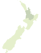

Scroll down to see a more detailed road map and below that a topographical map showing the location of Diehard Stream. The road map has been supplied by openstreetmap and the topographical map of Diehard Stream has been supplied by Land Information New Zealand (LINZ).

Yes you can use the top static map for you school/university project or personal website with a link back. Contact me for any commercial use.

Diehard Stream Map New Zealand


New Zealand places in our database
[ A ] [ B ] [ C ] [ D ] [ E ] [ F ] [ G ] [ H ] [ I ] [ J ] [ K ] [ L ] [ M ] [ N ] [ O ] [ P ] [ Q ] [ R ] [ S ] [ T ] [ U ] [ V ] [ W ] [ X ] [ Y ] [ Z ]


Closest 20 Streams to Diehard Stream

Whalebone Stream ( 1.12km )   Bullion Stream ( 1.7km )   Tapu River ( 2.11km )   Waipatukahu Stream ( 2.11km )   Otuturu Stream ( 2.63km )   Te Kaka Stream ( 3km )   Te Mata River ( 3.27km )   Plummey Stream ( 3.32km )   Otaki Creek ( 3.53km )   Pohue Stream ( 3.65km )   Pohoi Stream ( 3.65km )   Black Swan Stream ( 4.2km )   Oapa Creek ( 4.2km )   Gentle Annie Stream ( 4.32km )   Osborne Stream ( 4.83km )   Paroquet Stream ( 4.84km )   Buggy Stream ( 4.88km )   Ryan Stream ( 4.9km )   Donkin Stream ( 4.98km )   Waiomu Stream ( 5.14km )   Comstock Stream ( 5.24km )   Waipahaki Stream ( 5.33km )   Golden Drop Stream ( 5.6km )   Waikawau River ( 5.78km )   Stony Stream ( 6.23km )   Whakarewa Stream ( 6.29km )   Ten Mile Stream ( 6.3km )   Te Puru Stream ( 7.26km )   Waiwhero Stream ( 7.39km )   Omako Creek ( 8.04km )   Pokopokorua Stream ( 8.28km )   Hunt Stream ( 8.75km )   Wairotoroto Stream ( 8.78km )   King Fern Stream ( 8.92km )   Jerry Stream ( 9km )   Pupurakau Stream ( 9km )   Dairy Creek ( 9.01km )   Waterfall Stream ( 9.14km )   Otohi Stream ( 9.18km )   Waitoetoe Stream ( 9.71km )