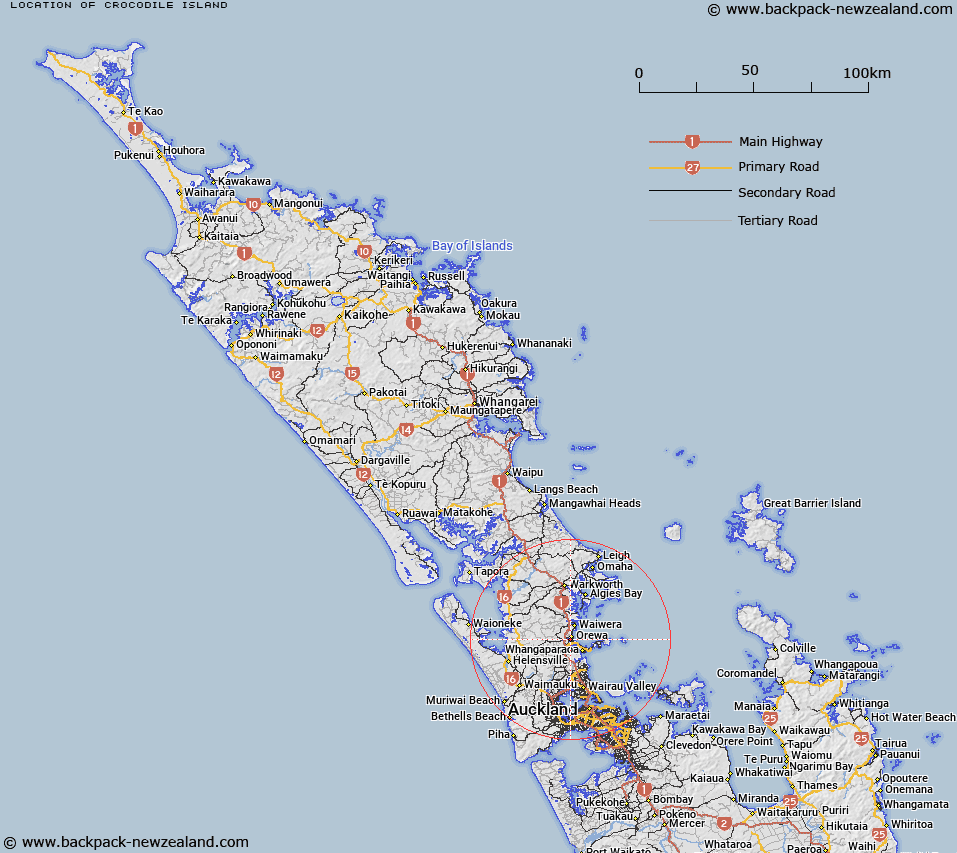
Map showing location of Crocodile Island


LINZ description: An island located in the tidal estuary of the Orewa River approximately 1 km southwest of Orewa. NZTopo50 AZ31, GR 512 484. Feature shown on: NZMS260 R10
Latitude: -36.597583
Longitude: 174.690472
Northing: 5948437.4
Easting: 1751206.9
Land District: North Auckland
Feat Type: Island


Scroll down to see a more detailed road map and below that a topographical map showing the location of Crocodile Island. The road map has been supplied by openstreetmap and the topographical map of Crocodile Island has been supplied by Land Information New Zealand (LINZ).

Yes you can use the top static map for you school/university project or personal website with a link back. Contact me for any commercial use.
Crocodile Island Map New Zealand


New Zealand places in our database
[ A ] [ B ] [ C ] [ D ] [ E ] [ F ] [ G ] [ H ] [ I ] [ J ] [ K ] [ L ] [ M ] [ N ] [ O ] [ P ] [ Q ] [ R ] [ S ] [ T ] [ U ] [ V ] [ W ] [ X ] [ Y ] [ Z ]


Closest 20 Islands to Crocodile Island

Mahurangi Island ( 6.36km )   Brazier Rock ( 8.28km )   Kotanui Island (Frenchmans Cap) ( 8.86km )   Pudding Island ( 9.99km )   Te Haupa Island ( 10.74km )   Casnell Island ( 12.34km )   The Tor ( 13.11km )   Motuora Island ( 14.3km )   Grants Island ( 15.28km )   Moturekareka Island ( 16.08km )   Rocky Islets ( 16.09km )   Motutara Island ( 16.27km )   Wooded Island ( 17.32km )   Motuketekete Island ( 17.79km )   Tiritiri Matangi Island ( 18.29km )   Shag Rock ( 19.25km )   Beehive Island (Taungamaro Island) ( 19.97km )   Herald Island ( 20.48km )   Pine Island ( 20.48km )   Martello Rock (Ruakoura) ( 20.76km )   Archway Island ( 20.88km )   Takangaroa Island ( 21.29km )   Goat Island ( 21.29km )   Mayne Islands ( 21.35km )   Twins ( 21.66km )   Rabbit Island ( 22.27km )   Challenger Island (Little Kawau Island) ( 22.87km )   Little Markham Island ( 23.33km )   Pembles Island (Tangaroa) ( 24.35km )   Kawau Island ( 24.93km )   Woody Island ( 25.79km )   Orarapa Island (The Haystack) ( 26.01km )   Three Sisters ( 26.15km )   Ng? Tuaitara-a-Taikehu ( 26.38km )   Rangitoto Island ( 26.38km )   Te Rangi-i-Totongia-a-Tamatekapua ( 26.38km )   Motuhoropapa Island ( 26.52km )   Motuhurakia Island ( 26.52km )   Rakino Island ( 26.56km )   Slip Island ( 26.61km )