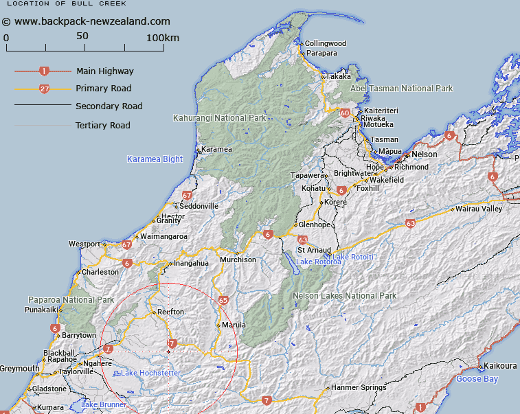
Map showing location of Bull Creek


LINZ description: Feature shown on: NZMS260 L31 Edition 2 1996
Latitude: -42.329417
Longitude: 171.939722
Northing: 5313103.6
Easting: 1512644.2
Land District: Nelson
Feat Type: Stream


Scroll down to see a more detailed road map and below that a topographical map showing the location of Bull Creek. The road map has been supplied by openstreetmap and the topographical map of Bull Creek has been supplied by Land Information New Zealand (LINZ).

Yes you can use the top static map for you school/university project or personal website with a link back. Contact me for any commercial use.
Bull Creek Map New Zealand


New Zealand places in our database
[ A ] [ B ] [ C ] [ D ] [ E ] [ F ] [ G ] [ H ] [ I ] [ J ] [ K ] [ L ] [ M ] [ N ] [ O ] [ P ] [ Q ] [ R ] [ S ] [ T ] [ U ] [ V ] [ W ] [ X ] [ Y ] [ Z ]


Closest 20 Streams to Bull Creek

Mullocky Creek ( 0.76km )   Absolum Creek ( 1.93km )   Hurley Creek ( 2.08km )   Snow Creek ( 2.8km )   Alexander River ( 2.82km )   Staircase Creek ( 4.45km )   Upper Grey River ( 5.78km )   Frank Creek ( 6.06km )   Paddys Creek ( 7.41km )   Otto River ( 7.7km )   Mica Creek ( 7.88km )   Clarke River ( 8.57km )   Crate Creek ( 8.7km )   Heslop Creek ( 9.4km )   Quartz Creek ( 9.98km )   Suicide Creek ( 10.26km )   Brown Creek ( 10.32km )   Blue Speck Creek ( 10.5km )   Sunderland Creek ( 10.66km )   Bullswool Creek ( 11.01km )   Duffy Creek ( 11.17km )   Coorang Creek ( 11.18km )   One Horse Stream ( 11.37km )   Big River ( 11.43km )   Twenty Mile Creek ( 11.44km )   Golden Lead Creek ( 11.69km )   May Creek ( 11.85km )   Willis Creek ( 12.78km )   Deep Creek ( 12.78km )   Stringer Creek ( 12.86km )   Mount David Water Race ( 12.89km )   Ellis Creek ( 13.07km )   Rahu River Left Branch ( 13.11km )   Rough or Tobin Stream ( 13.23km )   A1 Creek ( 13.27km )   Krantz Creek ( 13.28km )   Kapai Creek ( 13.32km )   Cumberland Creek ( 13.4km )   OK Creek ( 13.5km )   Brown Grey River ( 13.76km )