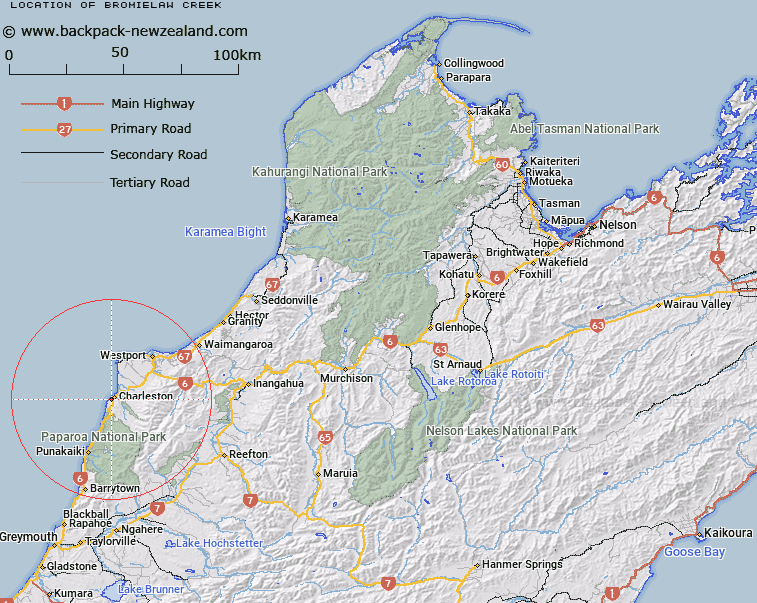
Map showing location of Bromielaw Creek


LINZ description: Feature shown on: NZMS260 K29 Edition 2 1994
Latitude: -41.913194
Longitude: 171.425528
Northing: 5358663
Easting: 1469427.1
Land District: Nelson
Feat Type: Stream


Scroll down to see a more detailed road map and below that a topographical map showing the location of Bromielaw Creek. The road map has been supplied by openstreetmap and the topographical map of Bromielaw Creek has been supplied by Land Information New Zealand (LINZ).

Yes you can use the top static map for you school/university project or personal website with a link back. Contact me for any commercial use.
Bromielaw Creek Map New Zealand


New Zealand places in our database
[ A ] [ B ] [ C ] [ D ] [ E ] [ F ] [ G ] [ H ] [ I ] [ J ] [ K ] [ L ] [ M ] [ N ] [ O ] [ P ] [ Q ] [ R ] [ S ] [ T ] [ U ] [ V ] [ W ] [ X ] [ Y ] [ Z ]


Closest 20 Streams to Bromielaw Creek

Deep Creek ( 1.18km )   Darkies Creek ( 1.58km )   Candlelight Creek ( 1.76km )   Waitakere or Nile River ( 2.08km )   Argyle Creek ( 2.93km )   Whisky Creek ( 3.02km )   Madmans Creek ( 5.1km )   Little Totara River ( 5.31km )   Makirikiri Stream ( 5.51km )   Four Mile or Tiropahi River ( 5.61km )   Morrisey Creek ( 6.91km )   Ananui Creek ( 7.65km )   Doubtful Creek ( 7.87km )   Eel Creek ( 7.94km )   Tailings Creek ( 8.06km )   White Horse Creek ( 8.21km )   Awakari River ( 8.39km )   Red Jacket Creek ( 8.86km )   O'Keefe Creek ( 9.56km )   Belfast Creek ( 9.67km )   Nick Creek ( 10.17km )   Waggon Creek ( 10.39km )   Pigeon Creek ( 10.64km )   Totara River ( 11.02km )   Atbara Creek ( 11.28km )   Sirdar Creek ( 11.31km )   Spring Creek ( 11.4km )   Zoedone Creek ( 11.62km )   Shamrock Creek ( 11.72km )   Okari River ( 12.01km )   Cave Creek North ( 12.17km )   Mountain Creek ( 12.44km )   O'Malley Creek ( 12.95km )   Blind River ( 13.27km )   Welsh Creek ( 13.76km )   Fox River ( 14.19km )   Marys Creek ( 14.28km )   Kitto Creek ( 15.18km )   Waterfall Creek ( 16.12km )   Limestone Creek ( 16.16km )