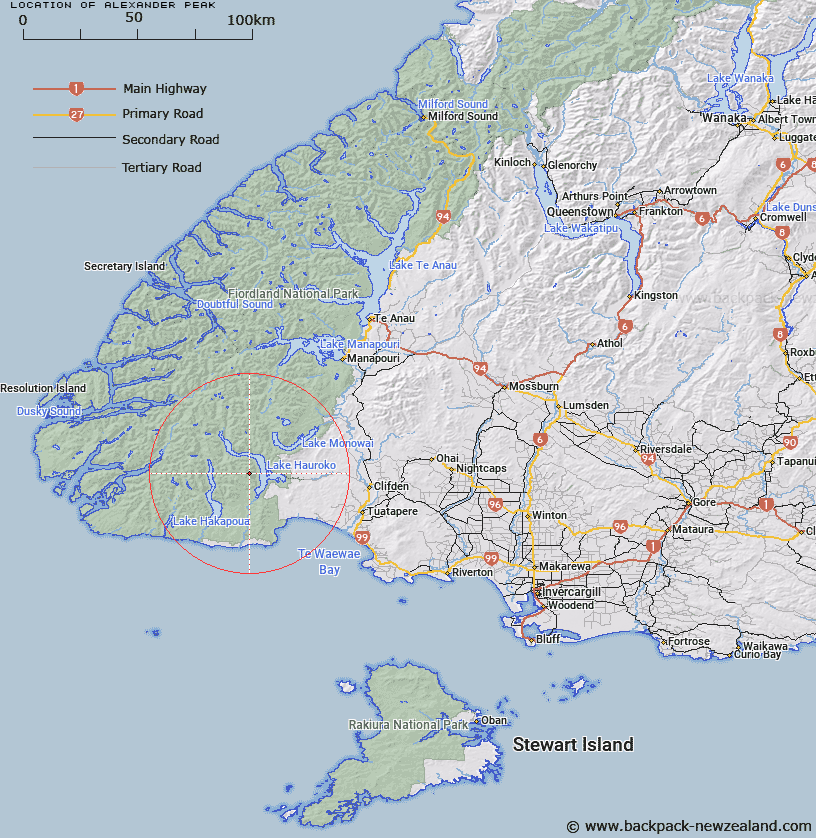
Map showing location of Alexander Peak


LINZ description: Located in the Princess Mountains, above the western shores of Lake Hauroko, Fiordland, at height 1504m. NZTopo50 CF06-Lake Poteriteri, GR 553 917.
Latitude: -45.983544
Longitude: 167.257866
Northing: 4891728
Easting: 1155267
Land District: Southland
Feat Type: Hill


Scroll down to see a more detailed road map and below that a topographical map showing the location of Alexander Peak. The road map has been supplied by openstreetmap and the topographical map of Alexander Peak has been supplied by Land Information New Zealand (LINZ).

Yes you can use the top static map for you school/university project or personal website with a link back. Contact me for any commercial use.
Alexander Peak Map New Zealand


New Zealand places in our database
[ A ] [ B ] [ C ] [ D ] [ E ] [ F ] [ G ] [ H ] [ I ] [ J ] [ K ] [ L ] [ M ] [ N ] [ O ] [ P ] [ Q ] [ R ] [ S ] [ T ] [ U ] [ V ] [ W ] [ X ] [ Y ] [ Z ]


Closest 20 Hills to Alexander Peak

Albert Edward Peak ( 1.07km )   Alice Peaks ( 5.59km )   Caroline Peak ( 6.55km )   Helena Peak ( 7.86km )   Oblong Hill ( 8.07km )   West Peak ( 10.65km )   White Peak ( 11.3km )   Poteriteri Peak ( 14.15km )   Ardeer Peak ( 14.41km )   The Hump ( 14.76km )   Helmet Hill ( 16.04km )   Tower Peak ( 16.51km )   Goldie Hill ( 16.77km )   Knoll Peak ( 18.21km )   End Peak ( 18.3km )   Solitary Peak ( 20.4km )   Cleughearn Peak ( 20.71km )   Hindley Peak ( 20.97km )   Rocky Top ( 21.34km )   Cone Peak ( 21.73km )   Edge Peak ( 22.56km )   Rugged Mount ( 23.25km )   Mount Cuthbert ( 23.27km )   Houseroof Hill ( 23.75km )   White Hill ( 24.26km )   Dean Hill ( 24.34km )   Mount Aitken ( 26.29km )   Mount Aitkin ( 26.29km )   Sea View Peak ( 27.82km )   Mount Puteketeke ( 27.97km )   Arnett Peak ( 28.35km )   Mount Burns ( 28.87km )   Kathryn Peak ( 28.89km )   Eldrig Peak ( 28.95km )   Caton Peak ( 29.75km )   Masons Hill ( 30.31km )   Mount McGavock ( 31.03km )   Mount Bates ( 31.29km )   Diggers Hill ( 32.25km )   White Hill ( 32.57km )