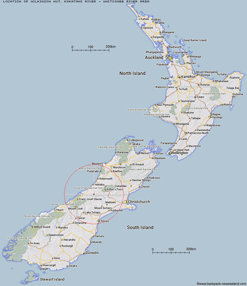
Topo Map showing location of Wilkinson Hut
This information is sourced from DoC, LINZ and Openstreetmap. Some of the hut photos are mine and the rest are from DoC. I will be adding an upload feature soon so people can photos of .Wilkinson Hut.
Basic info: basic four-bunk hut in the Hokitika area.
Latitude: -43.1567401864
Longitude: 170.98985443
Location: Kokatahi River - Whitcombe River area
Area: West Coast
Type of Hut: Basic/bivvies
Tracks: Whitcombe Pass Track|Toaroha/Zit Saddle/Kokatahi/Lathrop Saddle/Styx River Route
Map: BW18 Topo Map | Road Map
Does this hut still exist? Have any more information? Contact
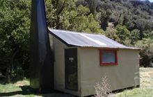
Image: DoC
Scroll down to see a topographical map and road map showing the location of Wilkinson Hut
[ A ] [ B ] [ C ] [ D ] [ E ] [ F ] [ G ] [ H ] [ I ] [ J ] [ K ] [ L ] [ M ] [ N ] [ O ] [ P ] [ Q ] [ R ] [ S ] [ T ] [ U ] [ V ] [ W ] [ Y ] [ Z ]
Closest 20 Huts to Wilkinson Hut
These are as the crow fliesNeave Hut 2.71km Price Basin Hut 3.57km Price Flat Hut 5.37km Price Flat Hut 5.53km Ivory Lake Hut 6.65km West Mathias Bivouac 8.17km Top Waitaha Hut 9.62km Top Tuke Hut 11.05km Centennial Cabin 11.28km County Stream Hut 11.36km Evans Hut 11.92km Mathias Hut 11.96km Frew Saddle Bivouac 12.13km Lauper Bivouac 12.59km Moraine Hut 12.61km Frew Hut 12.69km Smyth Hut 12.83km Healey Creek Hut 13.46km Washbourne Hut 13.48km Reischek Hut 13.84km Canyon Creek Bivouac 14.44km Dickie Spur Hut 14.62km Mikonui Spur Bivouac 14.8km Moonbeam Hut 14.88km Rapid Creek Hut 16.25km Bluff Hut 16.53km Banfield Hut 16.64km Frisco Hut 17.03km Lyell Hut 17.11km Jellicoe Hut 17.14km Polluck Creek Hut 17.14km Sir Robert Hut 17.3km Serpentine Hut 17.51km Mikonui Flat Hut 17.53km Explorer Hut 17.61km Thompsons Hut 18.71km Poet Hut 18.83km Kiwi Flat Hut 19.89km Scamper Torrent Hut 20.47km Toaroha Saddle Bivouac 20.48km