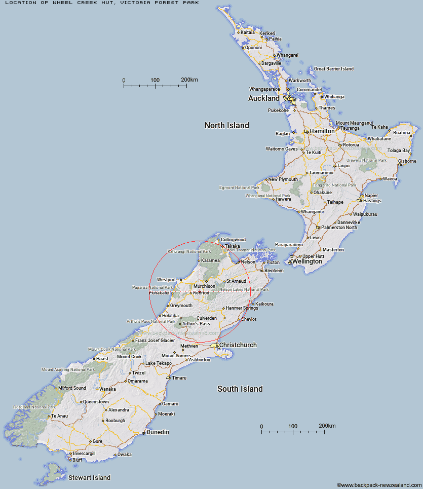
Topo Map showing location of Wheel Creek Hut
This information is sourced from DoC, LINZ and Openstreetmap. Some of the hut photos are mine and the rest are from DoC. I will be adding an upload feature soon so people can photos of .Wheel Creek Hut.
Basic info: basic six-bunk hut in the Greymouth area.
Latitude: -42.0708736422
Longitude: 172.131845678
Location: Victoria Forest Park
Area: West Coast
Type of Hut: Basic/bivvies
Map: BS22 Topo Map | Road Map
Does this hut still exist? Have any more information? Contact
Basic info: basic six-bunk hut in the Greymouth area.
Latitude: -42.0708736422
Longitude: 172.131845678
Location: Victoria Forest Park
Area: West Coast
Type of Hut: Basic/bivvies
Map: BS22 Topo Map | Road Map
Does this hut still exist? Have any more information? Contact
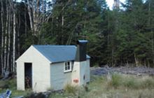
Image: DoC
Scroll down to see a topographical map and road map showing the location of Wheel Creek Hut
[ A ] [ B ] [ C ] [ D ] [ E ] [ F ] [ G ] [ H ] [ I ] [ J ] [ K ] [ L ] [ M ] [ N ] [ O ] [ P ] [ Q ] [ R ] [ S ] [ T ] [ U ] [ V ] [ W ] [ Y ] [ Z ]
Closest 20 Huts to Wheel Creek Hut
These are as the crow fliesKirwans Hut 10.68km Montgomerie Hut 14.12km Top Waitahu Bivouac 14.98km Lake Stream Hut 19.66km Nardoo Hut 24.8km Big River Hut 27.59km Burn Creek Hut 27.86km Manson-Nicholls Memorial Hut 29.09km Matakitaki Base Hut 32.6km Pell Stream Hut 32.96km Downie Hut 33.15km Bobs Hut 33.8km Ada Pass Hut 37.34km Cannibal Gorge Hut 37.58km East Matakitaki Hut 37.68km Mole Hut 38.35km Lyell Saddle Hut 38.68km George Lyon Hut 39.16km Upper D'Urville Hut 39.31km Ghost Lake Hut 41.3km Tiraumea Hut 41.37km Brass Monkey Bivouac 41.62km Lake Christabel Hut 41.97km Christopher Cullers Hut 42.3km Morgan Hut 42.36km Christopher Hut 43.12km Blue Lake Hut 43.22km Lucretia Hut 43.45km Caroline Creek Bivouac 44.53km Anne Cullers Hut 44.76km Anne Hut 45.17km Top Robinson Hut 45.46km Stern Valley Hut 45.62km Upper Nina Bivouac 45.81km West Sabine Hut 46.14km D'Urville Hut 46.32km Nina Hut 46.62km Buckland Peaks Hut 46.96km Mount Misery Hut 47.04km Mid Robinson Hut 47.82km