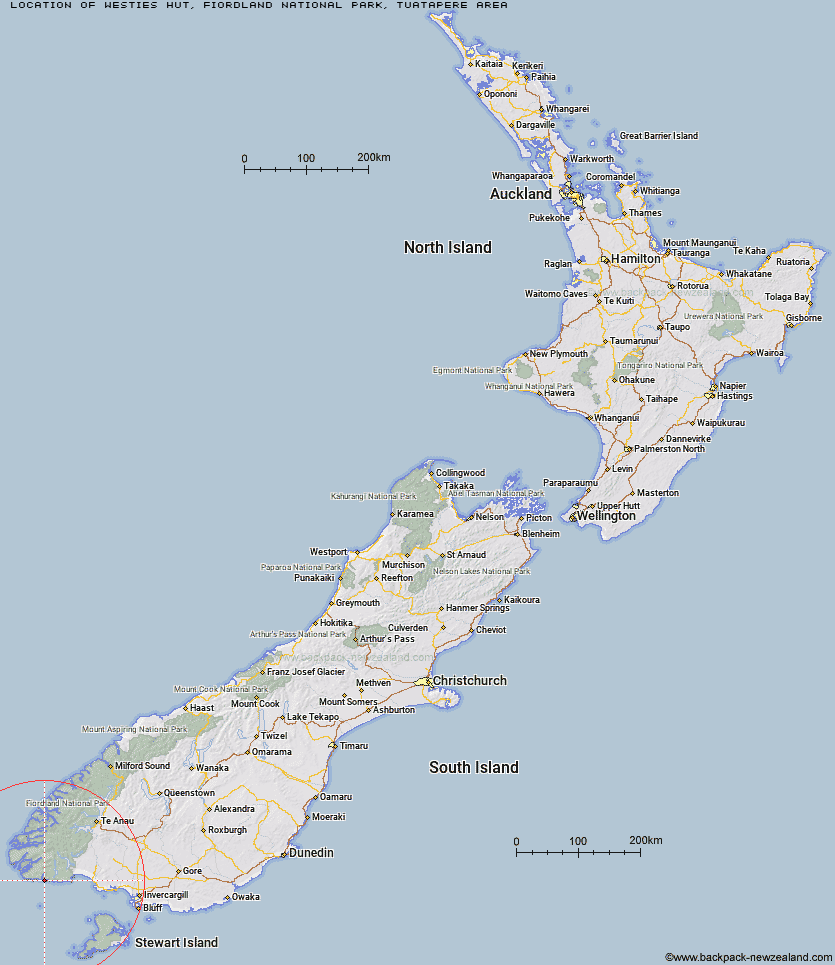
Topo Map showing location of Westies Hut
This information is sourced from DoC, LINZ and Openstreetmap. Some of the hut photos are mine and the rest are from DoC. I will be adding an upload feature soon so people can photos of .Westies Hut.
Basic info: 5-bunk basic hut on the South Coast Track, Fiordland.
Latitude: -46.2265919873
Longitude: 166.958550979
Location: Fiordland National Park, Tuatapere area
Area: Fiordland
Type of Hut: Basic/bivvies
Tracks: South Coast Track
Map: B46 Topo Map | Road Map
Does this hut still exist? Have any more information? Contact
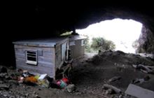
Image: DoC
Scroll down to see a topographical map and road map showing the location of Westies Hut
[ A ] [ B ] [ C ] [ D ] [ E ] [ F ] [ G ] [ H ] [ I ] [ J ] [ K ] [ L ] [ M ] [ N ] [ O ] [ P ] [ Q ] [ R ] [ S ] [ T ] [ U ] [ V ] [ W ] [ Y ] [ Z ]
Closest 20 Huts to Westies Hut
These are as the crow fliesWaitutu Hut 8.13km Slaughterburn Hut 9.12km Lake Poteriteri Hut 19.76km Wairaurahiri Hut 20.13km Te Oneroa Hut 24.89km Percy Burn Hut 26.71km Okaka Lodge 28.1km Port Craig School Hut 31km Port Craig Lodge 31.02km Teal Bay Hut 31.43km Caroline Hut 40.42km Hauroko Burn Hut 46.33km Eel Creek Hut 49.33km Monowai Hut 53.04km Halfway Hut 53.83km Rodger Inlet Huts 55.53km Clark Hut - A Frame 56.22km Historic Clark Hut 56.47km Supper Cove Hut 58.32km Green Lake Hut 59.73km Lake Roe Hut 59.89km Loch Maree Hut 60.8km Borland Bivouac 62.82km Turnbull's (Big Dam) Hut 69.1km Kintail Hut 69.12km Martin's Hut 69.46km North Borland Hut 72.65km Upper Spey Hut 73.59km Percy Shelter 76.3km Barcoo Hut 80.57km West Arm Hut 81.44km East Ruggedy Hut 81.8km Long Harry Hut 83.27km Rock Hut 83.73km Hope Arm Hut 83.94km Back Valley Hut 84.68km Smoky Hunters Hut 85.39km Telford Hut 86.5km Redcliff Hut 87.56km Yankee River Hut 88.2km