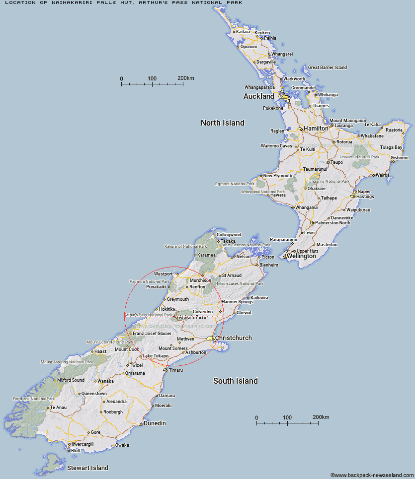
Topo Map showing location of Waimakariri Falls Hut
This information is sourced from DoC, LINZ and Openstreetmap. Some of the hut photos are mine and the rest are from DoC. I will be adding an upload feature soon so people can photos of .Waimakariri Falls Hut.
Basic info: basic six-bunk hut in the North Canterbury and Arthur's Pass area.
Latitude: -42.9176104249
Longitude: 171.487700837
Location: Arthur's Pass National Park
Area: Canterbury
Type of Hut: Basic/bivvies
Tracks: Carrington Hut Route
Map: BV20 Topo Map | Road Map
Does this hut still exist? Have any more information? Contact
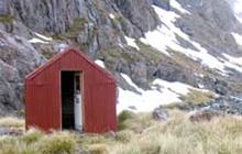
Image: DoC
Scroll down to see a topographical map and road map showing the location of Waimakariri Falls Hut
[ A ] [ B ] [ C ] [ D ] [ E ] [ F ] [ G ] [ H ] [ I ] [ J ] [ K ] [ L ] [ M ] [ N ] [ O ] [ P ] [ Q ] [ R ] [ S ] [ T ] [ U ] [ V ] [ W ] [ Y ] [ Z ]
Closest 20 Huts to Waimakariri Falls Hut
These are as the crow fliesCrow Hut 3.74km Old Julia Hut 5.53km Julia Hut 5.6km Carrington Hut 5.69km Jacks Hut 5.8km Mid Taipo Hut 8.33km Hunts Creek Hut 8.62km Anti Crow Hut 9.32km Dunns Creek Hut 10.4km Barker Hut 10.8km Mudflats Hut 10.82km Campbell Bivouac 10.94km Greyneys Shelter 11.16km Upper Deception Hut 11.17km Goat Pass Hut 11.31km Mingha Bivouac 11.6km Newton Creek Hut 12.34km Klondyke Shelter 12.52km Park Morpeth Hut 13.31km Edwards Hut 13.33km Harman Hut 13.52km Scottys Bivouac 13.74km Bealey Spur Hut 14.47km Dillon Hut 14.62km Dillons Homestead Hut 14.92km Carroll Hut 15.08km Avoca Hut 15.79km Griffin Creek Hut 15.83km Rocky Creek Bivouac 15.92km Top Olderog Bivouac 16.04km Grassy Flat Hut 16.18km Lower Arahura Hut 16.71km Top Crawford Hut 17.12km Lower Olderog Bivouac 17.24km Browning Range Bivouac 17.38km Lagoon Saddle Hut 17.82km Lagoon Saddle A Frame Hut 17.88km Sudden Valley Bivouac 18.01km Newton Range Bivouac 18.09km Bealey Hut 18.31km