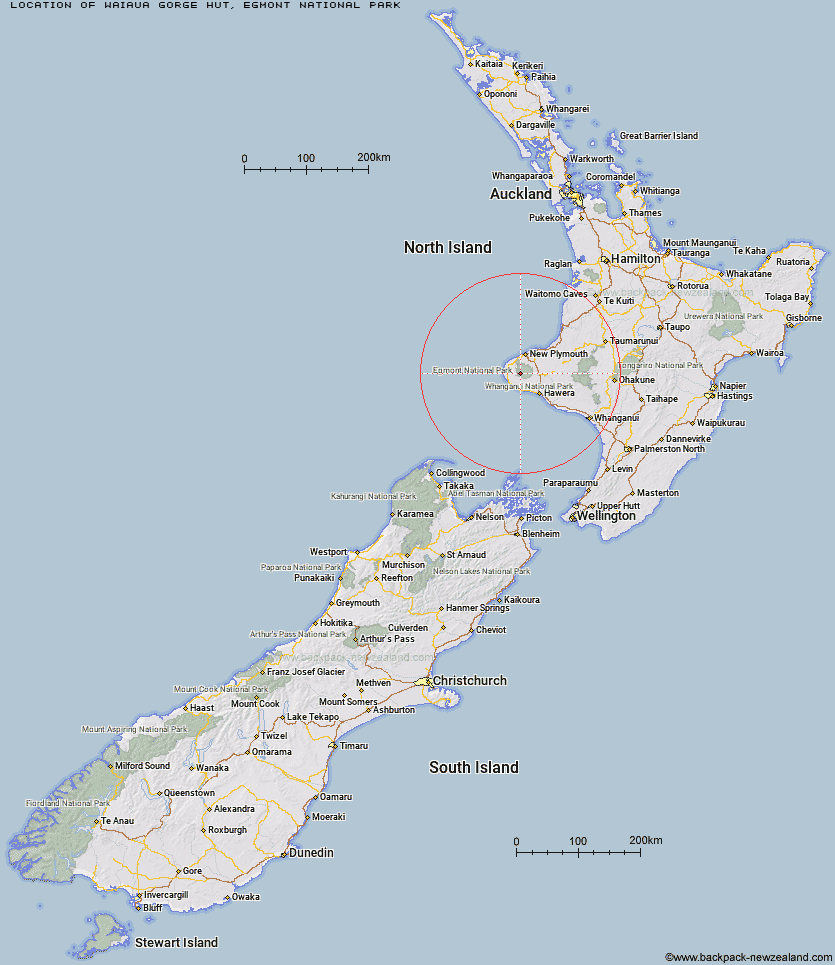
Topo Map showing location of Waiaua Gorge Hut
This information is sourced from DoC, LINZ and Openstreetmap. Some of the hut photos are mine and the rest are from DoC. I will be adding an upload feature soon so people can photos of .Waiaua Gorge Hut.
Basic info: This hut is a hidden gem in the wilderness of Mt Taranaki's west side. Bring your family for a day tramp or stay overnight to experience the park at night.
Latitude: -39.3252172741
Longitude: 174.003720383
Location: Egmont National Park
Area: Taranaki
Type of Hut: Serviced
Tracks: West Egmont tramping tracks|Around the Mountain Circuit
Map: BJ29 Topo Map | Road Map
Does this hut still exist? Have any more information? Contact
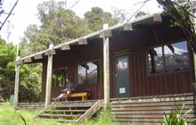
Image: DoC
Scroll down to see a topographical map and road map showing the location of Waiaua Gorge Hut
[ A ] [ B ] [ C ] [ D ] [ E ] [ F ] [ G ] [ H ] [ I ] [ J ] [ K ] [ L ] [ M ] [ N ] [ O ] [ P ] [ Q ] [ R ] [ S ] [ T ] [ U ] [ V ] [ W ] [ Y ] [ Z ]
Closest 20 Huts to Waiaua Gorge Hut
These are as the crow fliesKahui Hut 3.58km Waiweranui Trust Hut 4.81km Lake Dive Hut 5.05km Syme Hut 5.64km Hooker Shelter 7.28km Holly Hut 7.69km Waingongoro Hut 9.21km Maketawa Hut 9.53km Pouakai Hut 10.43km Kaiauai Shelter 11.83km Trains Hut 64.73km Omaru Hut 66.74km Tahupo Hut 67.32km Puteore Hut 67.76km Pouri Hut 72.9km Rerekapa Hut 75.62km Ngapurua Hut 77.96km John Coull Hut 78.97km Puketotara Hut 83.71km Tieke Kainga 85.11km Ohuraiti Hut 94.01km Downes hut 106.51km Leitchs Hut 119.84km Mangaturuturu Hut 128.92km Ten Man Hut 129.12km Lupton Hut 130.61km Whakapapaiti Hut 130.66km Blyth Hut 130.85km Mangaehuehu Hut 133.01km Whangaehu Hut 136.45km Mangatepopo Hut 138.66km Rangipo Hut 139.41km Ketetahi Shelter 144.12km Old Waihohonu Hut 144.25km Waihohonu Hut 144.86km Hauhungaroa Hut 145.62km Oturere Hut 146.33km Zekes Hut 151.62km Hamilton Tomo Group Hut 151.89km Waihaha Hut 154.76km