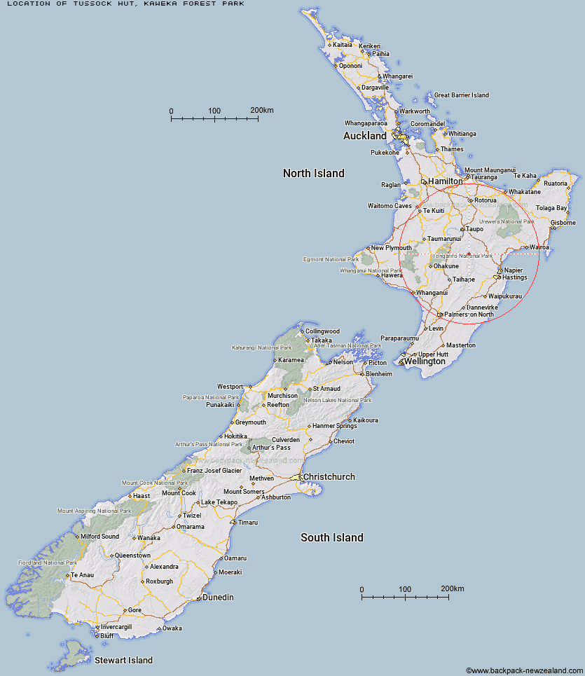
Topo Map showing location of Tussock Hut
This information is sourced from DoC, LINZ and Openstreetmap. Some of the hut photos are mine and the rest are from DoC. I will be adding an upload feature soon so people can photos of .Tussock Hut.
Basic info: Tussock Hut is located at the upper (northern) end of Tussock Valley, on a tributary of Ngaawapurua (Harkness) Stream.
Latitude: -39.1656086036
Longitude: 176.215336964
Location: Kaweka Forest Park
Area: Hawke's Bay
Type of Hut: Standard
Map: BH37 Topo Map | Road Map
Does this hut still exist? Have any more information? Contact
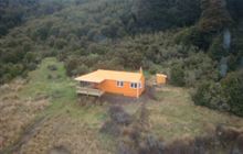
Image: DoC
Scroll down to see a topographical map and road map showing the location of Tussock Hut
[ A ] [ B ] [ C ] [ D ] [ E ] [ F ] [ G ] [ H ] [ I ] [ J ] [ K ] [ L ] [ M ] [ N ] [ O ] [ P ] [ Q ] [ R ] [ S ] [ T ] [ U ] [ V ] [ W ] [ Y ] [ Z ]
Closest 20 Huts to Tussock Hut
These are as the crow fliesHarkness Hut 3.9km Te Puke (Te Pukeohikarua) Hut 6.12km Mangatainoka Hut 7.1km Golden Hills Hut 7.88km Ngaawapurua Hut 8.16km WTFRW Hut 8.58km East Creek Hut 10.79km Oamaru Hut 10.89km Omarukokere Bivouac 11.47km Mangaturutu Hut 11.53km Otutu Island Hut 11.59km Poronui Hut 11.74km Otutu Hut 12.1km Red Hut 12.65km Venison Tops Hut (Tira Lodge) 12.89km Te Apunga Hut 13.85km Rocks Ahead Bivouac 14.05km Rocks Ahead Hut 14.09km Cascade Hut 14.95km Manson Hut 15.02km Old Manson Hut 15.18km Ballard Hut 15.55km Manson Bivouac 15.93km Makino Hut 16.79km Back Ridge Bivouac 17km Back Ridge Hut 17.34km Tevers Hut 17.48km Te Matai Hut 17.83km Ernie's Creek Hut 18.45km Kiwi Mouth Hut 18.62km Rock Camp Bivouac 19.32km Middle Hill Hut 19.45km Studholme Saddle Hut 19.79km Dominie Hut 20km Studholme Saddle Bivouac 20.13km Kaweka Flats Bivouac 20.4km Upper Ripia Hut 20.62km Kiwi Saddle Hut 20.71km Iron Whare 21.11km Makahu Saddle Hut 21.37km