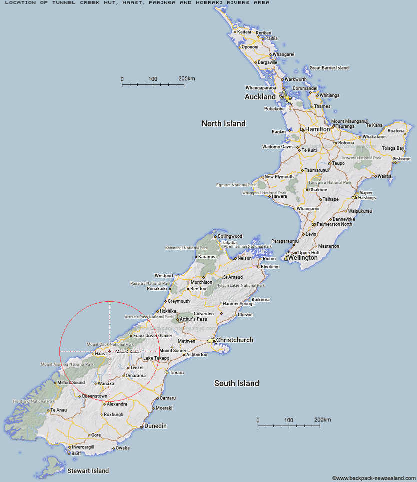
Topo Map showing location of Tunnel Creek Hut
This information is sourced from DoC, LINZ and Openstreetmap. Some of the hut photos are mine and the rest are from DoC. I will be adding an upload feature soon so people can photos of .Tunnel Creek Hut.
Basic info: basic six-bunk hut in the South Westland area.
Latitude: -43.8184452708
Longitude: 169.536974809
Location: Haast, Paringa and Moeraki rivers area
Area: West Coast
Type of Hut: Basic/bivvies
Map: BY13 Topo Map | Road Map
Does this hut still exist? Have any more information? Contact
Basic info: basic six-bunk hut in the South Westland area.
Latitude: -43.8184452708
Longitude: 169.536974809
Location: Haast, Paringa and Moeraki rivers area
Area: West Coast
Type of Hut: Basic/bivvies
Map: BY13 Topo Map | Road Map
Does this hut still exist? Have any more information? Contact
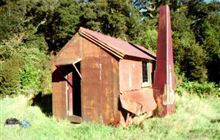
Image: DoC
Scroll down to see a topographical map and road map showing the location of Tunnel Creek Hut
[ A ] [ B ] [ C ] [ D ] [ E ] [ F ] [ G ] [ H ] [ I ] [ J ] [ K ] [ L ] [ M ] [ N ] [ O ] [ P ] [ Q ] [ R ] [ S ] [ T ] [ U ] [ V ] [ W ] [ Y ] [ Z ]
Closest 20 Huts to Tunnel Creek Hut
These are as the crow fliesMiddle Head Hut 6.6km Horseshoe Flat Hut 9.92km Blue River (Blowfly) Hut 15.6km Creswicke Flat Hut 16.84km Roaring Billy Hut 19.17km Maori Saddle Hut 21.1km Brodrick Hut 23.23km Wills Hut 25.2km Forbes Hut 26.47km Cullers Hut 26.63km Elcho Hut 26.65km Main Huxley Forks Hut 26.76km Thomas River Hut 28.66km Dodger Hut 28.75km Dasler Bivouac 29.12km Lame Duck Hut 29.26km Cassel Flat Hut 29.3km Coppermine Creek Hut 29.64km South Huxley Bivouac 30.19km Erceg Hut 30.56km Richardson Rock Bivouac 30.73km Red Hut 31.1km Brewster Hut 31.57km Monument Hut 31.74km Christmas Flat Hut 31.85km Ferguson Hut 33.49km Horace Walker Hut 34.14km Kennedy Hut 34.89km Grough Hut 35.25km Top Hut 35.29km Makarora Hut 35.42km Waterfall Hut 36.31km Architect Creek Hut 36.33km Reardon Hut 37.13km Harpers Rock Bivouac 37.61km Bull Flat Hut 37.76km Station Hut 37.78km Barron Saddle Hut 37.79km Le Crens Hut 37.82km Hagens Hut 38.36km