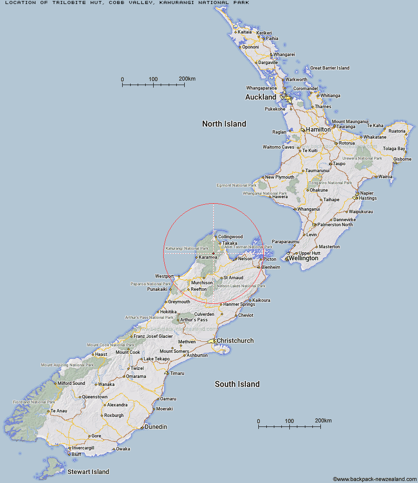
Topo Map showing location of Trilobite Hut
This information is sourced from DoC, LINZ and Openstreetmap. Some of the hut photos are mine and the rest are from DoC. I will be adding an upload feature soon so people can photos of .Trilobite Hut.
Basic info: standard 12-bunk hut in the Golden Bay area.
Latitude: -41.1302467455
Longitude: 172.609165071
Location: Cobb Valley, Kahurangi National Park
Area: Nelson/Tasman
Type of Hut: Standard
Map: BP24 Topo Map | Road Map
Does this hut still exist? Have any more information? Contact
Basic info: standard 12-bunk hut in the Golden Bay area.
Latitude: -41.1302467455
Longitude: 172.609165071
Location: Cobb Valley, Kahurangi National Park
Area: Nelson/Tasman
Type of Hut: Standard
Map: BP24 Topo Map | Road Map
Does this hut still exist? Have any more information? Contact
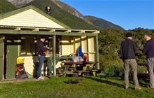
Image: DoC
Scroll down to see a topographical map and road map showing the location of Trilobite Hut
[ A ] [ B ] [ C ] [ D ] [ E ] [ F ] [ G ] [ H ] [ I ] [ J ] [ K ] [ L ] [ M ] [ N ] [ O ] [ P ] [ Q ] [ R ] [ S ] [ T ] [ U ] [ V ] [ W ] [ Y ] [ Z ]
Closest 20 Huts to Trilobite Hut
These are as the crow fliesMyttons Hut 1.21km Sylvester Hut 3.99km Balloon Hut 4.46km Chaffey Hut 5.09km Dry Rock Shelter 6.79km Growler Rock Shelter 6.85km Asbestos Cottage 6.93km Splugeons Rock Shelter 8.35km Upper Gridiron Hut and Rock Shelters 8.59km Tent Camp 9.38km Cobb Hut 10.86km Waingaro Forks Hut 10.88km Fenella Hut 11.4km Mt Arthur Hut 11.65km Flora Hut 11.67km Ellis Hut 13.56km Soper Shelter 13.82km Karamea Bend Hut 14.08km Riordans Hut 14.64km Flanagans Hut 15.81km Roaring Lion Hut 16.51km Lonely Lake Hut 16.97km Tin Hut Shelter 17.99km Anatoki Forks Hut 21.24km Adelaide Tarn Hut 21.58km Crow Hut 21.62km Venus Hut 25.14km Boulder Lake Hut 25.73km Thor Hut 28.61km Greys Hut 30.42km John Reid Hut 30.64km Perry Saddle Hut 30.8km Kiwi Saddle Hut 32.23km Brown Hut 33.96km Adams Flat Hut 34.03km Kākāpō Hut 34.04km Gouland Downs Hut 34.22km Castle Rock Hut 34.45km Sunshine Flat Shelter 34.51km Moa Park Shelter 34.75km