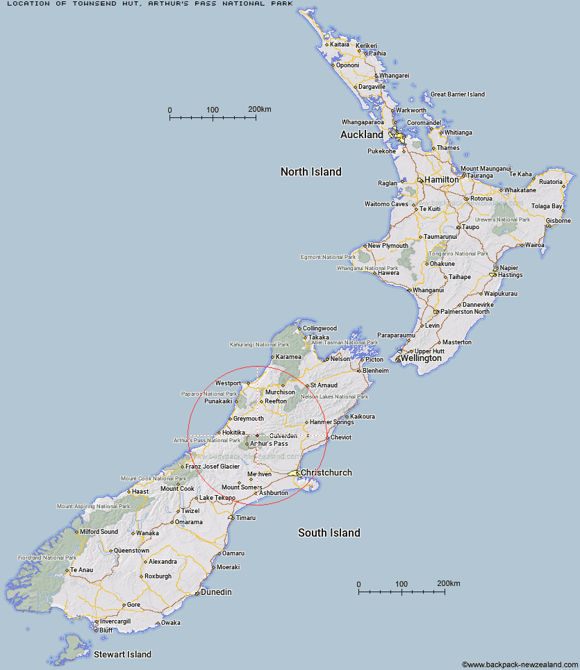
Topo Map showing location of Townsend Hut
This information is sourced from DoC, LINZ and Openstreetmap. Some of the hut photos are mine and the rest are from DoC. I will be adding an upload feature soon so people can photos of .Townsend Hut.
Basic info: basic four-bunk hut in Arthur's Pass National Park.
Latitude: -42.7742731722
Longitude: 171.777537557
Location: Arthur's Pass National Park
Area: Canterbury
Type of Hut: Basic/bivvies
Map: BU21 Topo Map | Road Map
Does this hut still exist? Have any more information? Contact
Basic info: basic four-bunk hut in Arthur's Pass National Park.
Latitude: -42.7742731722
Longitude: 171.777537557
Location: Arthur's Pass National Park
Area: Canterbury
Type of Hut: Basic/bivvies
Map: BU21 Topo Map | Road Map
Does this hut still exist? Have any more information? Contact
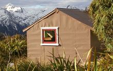
Image: DoC
Scroll down to see a topographical map and road map showing the location of Townsend Hut
[ A ] [ B ] [ C ] [ D ] [ E ] [ F ] [ G ] [ H ] [ I ] [ J ] [ K ] [ L ] [ M ] [ N ] [ O ] [ P ] [ Q ] [ R ] [ S ] [ T ] [ U ] [ V ] [ W ] [ Y ] [ Z ]
Closest 20 Huts to Townsend Hut
These are as the crow fliesKiwi Hut 3.39km Minchin Bivouac 3.5km Poulter Bivouac 4.59km Koropuku Hut 5.46km Locke Stream Hut 5.76km Worsley Bivouac 8.6km Poulter Hut 8.76km Top Trent / Lagoon Hut 9.44km Elizabeth Hut 9.56km Pfeifer Bivouac 9.71km Trust/Poulter Hut 10.41km Top Crooked Hut 10.5km Otehake Hut 10.75km Cone Creek Hut 10.84km Harper Pass Bivouac 11.16km Ranger Bivouac 13.26km Mid Trent Hut 13.41km Lake Morgan Hut 13.53km East Hawdon Bivouac 13.98km Jacko Flat Hut 14.07km Hawdon Hut 15.65km Camerons Hut 15.91km Upper South Branch Hurunui Hut 17.15km Upper Deception Hut 17.9km Carroll Hut 18.48km Waikiti Hut 18.84km Goat Pass Hut 18.85km Hurunui No 3 Hut 19.03km Camp Creek Hut 19.22km Sudden Valley Bivouac 20.39km Bull Creek Hut 20.41km Mingha Bivouac 20.43km Candlesticks Bivouac 20.98km Edwards Hut 21.42km Turnbull Bivouac 22.86km Hunts Creek Hut 23.69km Dillon Hut 23.76km Hawdon Shelter 23.85km Tutaekuri Hut 23.85km Dillons Homestead Hut 23.89km