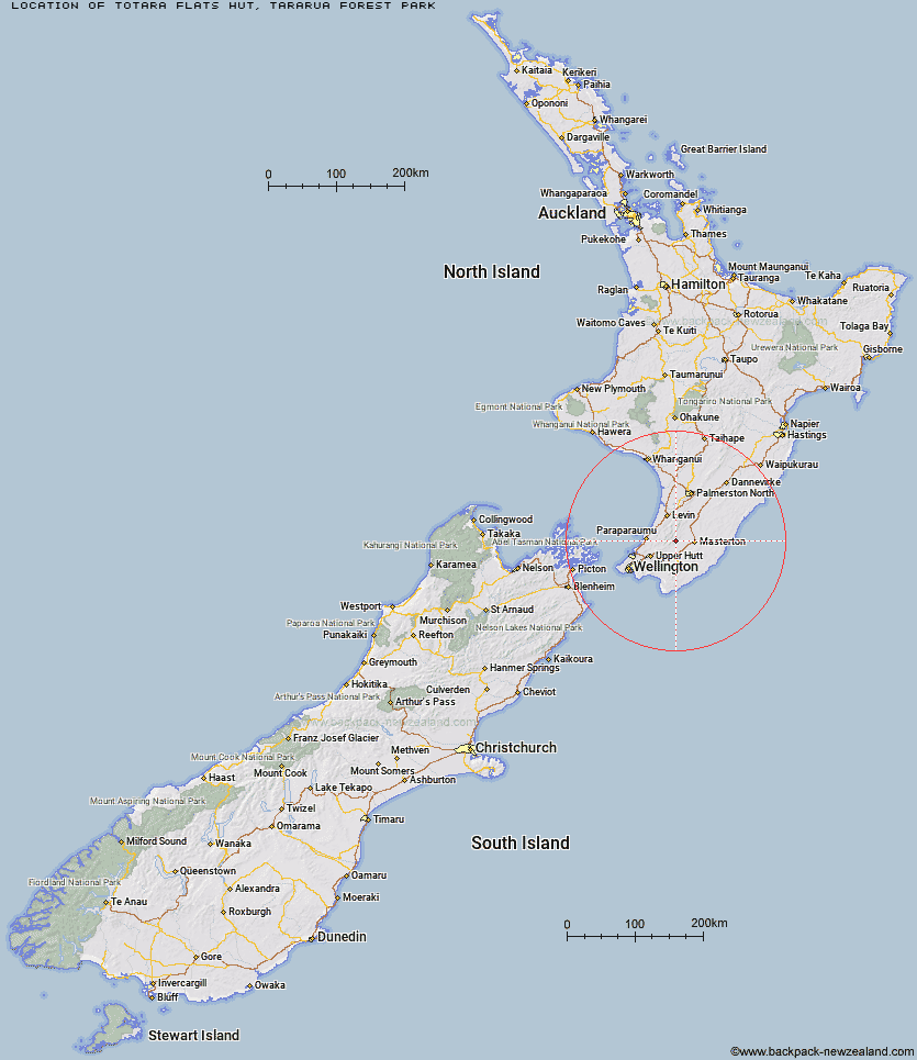
Topo Map showing location of Totara Flats Hut
This information is sourced from DoC, LINZ and Openstreetmap. Some of the hut photos are mine and the rest are from DoC. I will be adding an upload feature soon so people can photos of .Totara Flats Hut.
Basic info: This hut is a great overnight tramp for families with children or new trampers.
Latitude: -40.932686146
Longitude: 175.403151037
Location: Tararua Forest Park
Area: Wairarapa
Type of Hut: Serviced
Tracks: Holdsworth - Kaitoke Track
Map: BP33 Topo Map | Road Map
Does this hut still exist? Have any more information? Contact
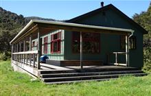
Image: DoC
Scroll down to see a topographical map and road map showing the location of Totara Flats Hut
[ A ] [ B ] [ C ] [ D ] [ E ] [ F ] [ G ] [ H ] [ I ] [ J ] [ K ] [ L ] [ M ] [ N ] [ O ] [ P ] [ Q ] [ R ] [ S ] [ T ] [ U ] [ V ] [ W ] [ Y ] [ Z ]
Closest 20 Huts to Totara Flats Hut
These are as the crow fliesSayer Hut 1.71km Neill Forks Hut 3.96km Mountain House Shelter 4.87km Powell Hut 5.61km Aokaparangi Hut 5.79km Maungahuka Hut 6.24km Mid Waiohine Hut 6.77km Cone Hut 7.8km Atiwhakatu Hut 8.35km Waiohine Shelter 8.4km Jumbo Hut 9.24km Anderson Memorial Hut 10.37km Penn Creek Hut 10.4km Tutuwai Hut 10.82km Kime Hut 11.1km McGregor Bivouac 11.14km Alpha Hut 11.77km Mid King Bivouac 12.31km Field Hut 12.65km Mitre Flats Hut 13.01km Nichols Hut 13.81km Waitewaewae Hut 13.94km Dorset Ridge Hut 14.01km Elder Hut 14.99km Eastern Hutt Hut 15.1km Carkeek Hut 15.85km Tarn Ridge Hut 16.02km Smith Creek Shelter 17.12km Dracophyllum Hut 18.17km Blue Range Hut 18.29km Waiotauru Hut 18.32km Cow Creek Hut 18.85km Arete Forks Hut 19.14km Renata Hut 19.76km Arete Hut 20.67km Kapakapanui Hut 20.88km Te Matawai Hut 21.7km Waiopehu Hut 23.27km South Ohau Hut 23.9km Cattle Ridge Hut 24.07km