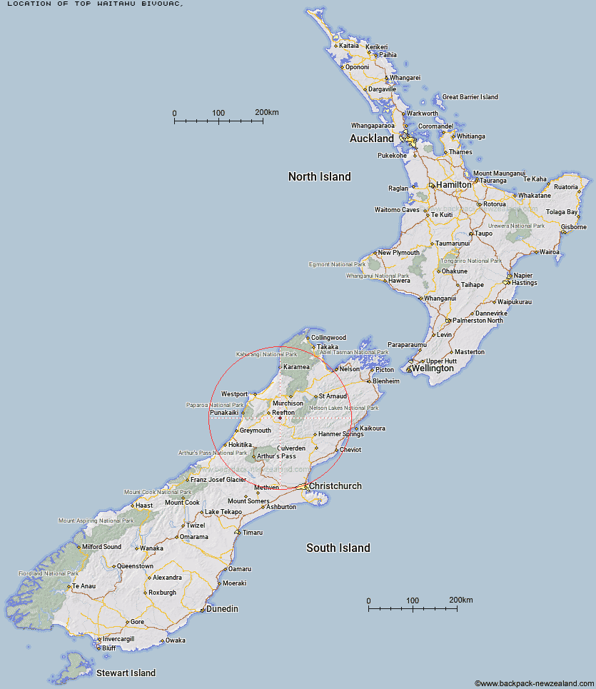
Topo Map showing location of Top Waitahu Bivouac
This information is sourced from DoC, LINZ and Openstreetmap. Some of the hut photos are mine and the rest are from DoC. I will be adding an upload feature soon so people can photos of .Top Waitahu Bivouac.
Latitude: -42.2044091504
Longitude: 172.108061446
Location:
Type of Hut:
Map: Topo Map | Road Map
Does this hut still exist? Have any more information? Contact
Latitude: -42.2044091504
Longitude: 172.108061446
Location:
Type of Hut:
Map: Topo Map | Road Map
Does this hut still exist? Have any more information? Contact
Scroll down to see a topographical map and road map showing the location of Top Waitahu Bivouac
[ A ] [ B ] [ C ] [ D ] [ E ] [ F ] [ G ] [ H ] [ I ] [ J ] [ K ] [ L ] [ M ] [ N ] [ O ] [ P ] [ Q ] [ R ] [ S ] [ T ] [ U ] [ V ] [ W ] [ Y ] [ Z ]
Closest 20 Huts to Top Waitahu Bivouac
These are as the crow fliesLake Stream Hut 5.21km Montgomerie Hut 10.97km Kirwans Hut 13.86km Wheel Creek Hut 14.98km Big River Hut 18.28km Manson-Nicholls Memorial Hut 18.66km Pell Stream Hut 23.18km Lake Christabel Hut 28.57km Burn Creek Hut 28.6km Nardoo Hut 29.13km Brass Monkey Bivouac 29.39km Cannibal Gorge Hut 29.78km Ada Pass Hut 30.83km Top Robinson Hut 31km Bobs Hut 31.21km Lucretia Hut 31.7km Upper Nina Bivouac 32.42km Mid Robinson Hut 32.87km Nina Hut 33.98km Devils Den Bivouac 35.03km Downie Hut 35.24km Doubtless Hut 36.63km East Matakitaki Hut 37.07km Anne Cullers Hut 37.55km Slaty Creek Hut 37.93km Christopher Cullers Hut 38.04km Anne Hut 38.28km Christopher Hut 38.76km Rokeby Hut 38.78km Doubtful Hut 39.07km Lake Man Bivouac 39.51km Matakitaki Base Hut 39.91km Jim's Flat Hut 40.23km Boyle Flat Hut 41.02km Upper D'Urville Hut 42.38km Top Hope Hut 43.21km Magdalen Hut 44.37km George Lyon Hut 44.55km Jervois Hut 45.22km Lake Guyon Hut 45.43km