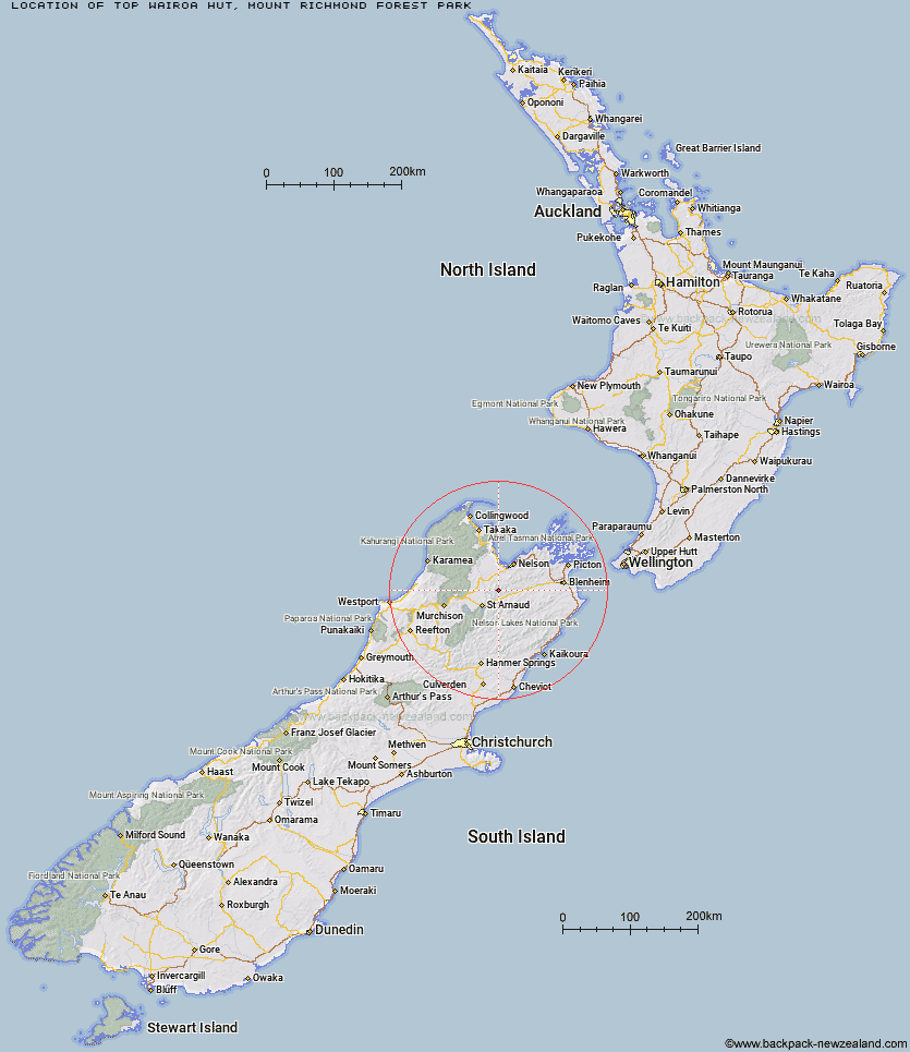
Topo Map showing location of Top Wairoa Hut
This information is sourced from DoC, LINZ and Openstreetmap. Some of the hut photos are mine and the rest are from DoC. I will be adding an upload feature soon so people can photos of .Top Wairoa Hut.
Basic info: standard 6-bunk hut in the Motueka area.
Latitude: -41.6108071947
Longitude: 173.075408228
Location: Mount Richmond Forest Park
Area: Nelson/Tasman
Type of Hut: Standard
Map: BR25 Topo Map | Road Map
Does this hut still exist? Have any more information? Contact
Basic info: standard 6-bunk hut in the Motueka area.
Latitude: -41.6108071947
Longitude: 173.075408228
Location: Mount Richmond Forest Park
Area: Nelson/Tasman
Type of Hut: Standard
Map: BR25 Topo Map | Road Map
Does this hut still exist? Have any more information? Contact
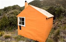
Image: DoC
Scroll down to see a topographical map and road map showing the location of Top Wairoa Hut
[ A ] [ B ] [ C ] [ D ] [ E ] [ F ] [ G ] [ H ] [ I ] [ J ] [ K ] [ L ] [ M ] [ N ] [ O ] [ P ] [ Q ] [ R ] [ S ] [ T ] [ U ] [ V ] [ W ] [ Y ] [ Z ]
Closest 20 Huts to Top Wairoa Hut
These are as the crow fliesMid Wairoa Hut 5.87km Hunters Hut 6.15km Porters Creek Hut 8.05km Lower Goulter Hut 8.37km Tarn Hut 10.12km Mid Goulter Hut 13.73km Red Hills Hut 15.09km Mt Rintoul Hut 15.8km Beebys Hut 17km Old Man Hut 18.88km Silverstream Bivouac 20.55km Lake Chalice Hut 20.91km Slaty Hut 21.9km Starveall Hut 21.92km Hidden Hut 23.25km Caves Hut 23.74km Mid Silverstream Hut 23.94km Boulder Forks Hut 24.86km Greigs Hut 25.23km Turkeys Nest Bivouac 25.47km Bull Paddock Creek Hut 25.52km Hacket Hut 25.9km Browning Hut 27.59km Gosling Hut 28.28km Lost Stream Bivouac 28.63km Barbers Hut 29.16km Richmond Saddle Hut 29.81km Siberia Hut 29.86km Top Misery Hut 31.13km Roebuck Hut 32.24km Bushline Hut 32.7km Bushedge Shelter 32.94km Mt Fell Hut 32.98km Relax Shelter 33.31km Bottom Misery Hut 33.49km Blue Mountain Hut 34.79km Bottom Gordons Hut 35.56km Rocks Hut 35.73km Coldwater Hut 35.96km Lakehead Hut 36.18km