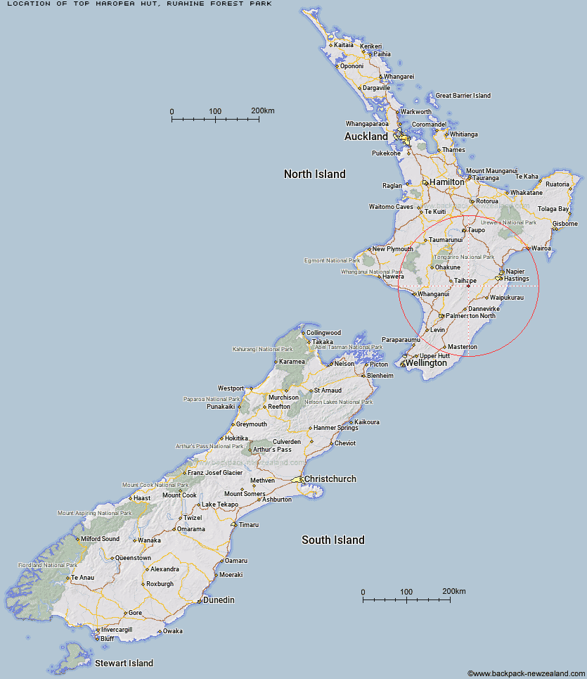
Topo Map showing location of Top Maropea Hut
This information is sourced from DoC, LINZ and Openstreetmap. Some of the hut photos are mine and the rest are from DoC. I will be adding an upload feature soon so people can photos of .Top Maropea Hut.
Basic info: basic four-bunk hut in the Manawatu region.
Latitude: -39.7744596577
Longitude: 176.158128345
Location: Ruahine Forest Park
Area: Manawatu/Whanganui
Type of Hut: Basic/bivvies
Map: BK36 Topo Map | Road Map
Does this hut still exist? Have any more information? Contact
Basic info: basic four-bunk hut in the Manawatu region.
Latitude: -39.7744596577
Longitude: 176.158128345
Location: Ruahine Forest Park
Area: Manawatu/Whanganui
Type of Hut: Basic/bivvies
Map: BK36 Topo Map | Road Map
Does this hut still exist? Have any more information? Contact
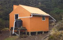
Image: DoC
Scroll down to see a topographical map and road map showing the location of Top Maropea Hut
[ A ] [ B ] [ C ] [ D ] [ E ] [ F ] [ G ] [ H ] [ I ] [ J ] [ K ] [ L ] [ M ] [ N ] [ O ] [ P ] [ Q ] [ R ] [ S ] [ T ] [ U ] [ V ] [ W ] [ Y ] [ Z ]
Closest 20 Huts to Top Maropea Hut
These are as the crow fliesSunrise Hut 1.68km Waipawa Forks Hut 3.07km Wakelings Hut 3.28km Gold Creek Hut 3.62km Triplex Hut 4.02km Sparrowhawk Bivouac 4.44km Waikamaka Hut 4.62km Maropea Forks Hut 5.24km McKinnon Hut 5.47km Crow Hut 6.29km Norris Hut 6.91km Waterfall Hut 7.13km Barlow Hut 8.12km Smiths Stream Hut 8.37km Hinerua Hut 9.76km Kawhatau Base 9.99km Otukota Hut 9.99km Purity Hut 10.08km Kylie Bivouac 11.11km Pourangaki Hut 11.46km Colenso Hut 11.54km Iron Bark Hut 11.74km Upper Makaroro Hut 12.09km Tarn Bivouac 12.19km Kelly Knight Hut 12.3km Ellis Hut 12.52km Parks Peak Hut 13.36km Poutaki Hut 14.35km Howletts Hut 14.7km Daphne Hut 15.47km Sentry Box Hut 15.78km Ruahine Corner Hut 15.97km Triangle Hut 16.08km Tin Hut 16.83km Aranga Hut 17.59km Rangiwahia Hut 17.6km Rockslide Hut 18.63km Iron Gate Hut 19.02km Briens Hut 19.73km Mistake Bivouac 19.88km