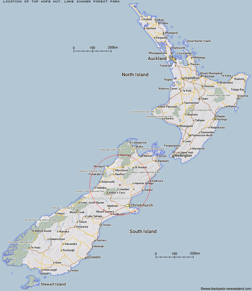
Topo Map showing location of Top Hope Hut
This information is sourced from DoC, LINZ and Openstreetmap. Some of the hut photos are mine and the rest are from DoC. I will be adding an upload feature soon so people can photos of .Top Hope Hut.
Basic info: basic six-bunk hut in the North Canterbury and Arthur's Pass area.
Latitude: -42.5897567374
Longitude: 172.175499345
Location: Lake Sumner Forest Park
Area: Canterbury
Type of Hut: Basic/bivvies
Tracks: Hope valley (Windy Point) tracks & routes
Map: BU22 Topo Map | Road Map
Does this hut still exist? Have any more information? Contact
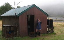
Image: DoC
Scroll down to see a topographical map and road map showing the location of Top Hope Hut
[ A ] [ B ] [ C ] [ D ] [ E ] [ F ] [ G ] [ H ] [ I ] [ J ] [ K ] [ L ] [ M ] [ N ] [ O ] [ P ] [ Q ] [ R ] [ S ] [ T ] [ U ] [ V ] [ W ] [ Y ] [ Z ]
Closest 20 Huts to Top Hope Hut
These are as the crow fliesSaint Jacob's Hut 5.26km Lake Man Bivouac 6.08km Three Mile Stream Hut 7.66km Museum Hut 8.01km Doubtless Hut 8.59km Slaty Creek Hut 8.94km Hope Halfway Hut 10.43km Doubtful Hut 10.97km Mackenzie Bivouac 11.1km Top Robinson Hut 12.41km Mid Robinson Hut 12.52km Lake Sumner Hut 13.31km Evangeline Bivouac 13.32km Hurunui Hut 14.24km Mackenzie Hut 14.4km Devils Den Bivouac 14.94km Upper Nina Bivouac 15.53km Bus Shelter 16.53km Lake Mason Hut 16.6km Tutaekuri Hut 16.89km Gabriel Hut 17.35km Lake Christabel Hut 18.19km Nina Hut 18.28km South Branch Research Hut 19.02km Jollie Brook Hut 19.42km Stony Stream Hut 19.54km Hurunui No 3 Hut 19.69km Brass Monkey Bivouac 22.17km Camerons Hut 22.69km Lucretia Hut 22.98km Cold Stream Hut 24.07km Bush Camp Hut 24.4km Upper South Branch Hurunui Hut 24.74km Glenrae Bivouac 24.77km North Esk Hut 24.97km Mid Trent Hut 25.54km Waikiti Hut 26.46km Deep Creek Hut 26.46km Carlyle Hut 26.59km Magdalen Hut 26.6km