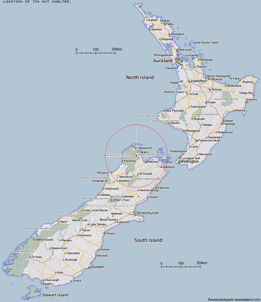
Topo Map showing location of Tin Hut Shelter
This information is sourced from DoC, LINZ and Openstreetmap. Some of the hut photos are mine and the rest are from DoC. I will be adding an upload feature soon so people can photos of .Tin Hut Shelter.
Latitude: -41.0149838235
Longitude: 172.759704496
Location:
Type of Hut:
Map: Topo Map | Road Map
Does this hut still exist? Have any more information? Contact
Latitude: -41.0149838235
Longitude: 172.759704496
Location:
Type of Hut:
Map: Topo Map | Road Map
Does this hut still exist? Have any more information? Contact
Scroll down to see a topographical map and road map showing the location of Tin Hut Shelter
[ A ] [ B ] [ C ] [ D ] [ E ] [ F ] [ G ] [ H ] [ I ] [ J ] [ K ] [ L ] [ M ] [ N ] [ O ] [ P ] [ Q ] [ R ] [ S ] [ T ] [ U ] [ V ] [ W ] [ Y ] [ Z ]
Closest 20 Huts to Tin Hut Shelter
These are as the crow fliesRiordans Hut 3.68km Waingaro Forks Hut 7.94km Soper Shelter 13.7km Asbestos Cottage 13.96km Sylvester Hut 14.01km Anatoki Forks Hut 15.25km Moa Park Shelter 17.09km Lonely Lake Hut 17.31km Castle Rock Hut 17.34km Wainui Hut 17.53km Myttons Hut 17.73km Trilobite Hut 17.99km Upper Gridiron Hut and Rock Shelters 18.1km Chaffey Hut 18.16km Growler Rock Shelter 18.33km Flora Hut 18.81km Tent Camp 19.57km Boulder Lake Hut 19.85km Adelaide Tarn Hut 19.86km Dry Rock Shelter 19.92km Fenella Hut 20.04km Cobb Hut 20.2km Balloon Hut 20.64km Mt Arthur Hut 20.65km Holyoake Clearing Shelter 21.09km Awapoto Hut 22.64km Splugeons Rock Shelter 24.66km Ellis Hut 25.53km Anchorage Hut 25.83km Bark Bay Hut 26.63km Awaroa Hut 27.32km Whariwharangi Hut 30.93km Flanagans Hut 31.85km Karamea Bend Hut 31.97km Brown Hut 32km Perry Saddle Hut 32.53km Roaring Lion Hut 34.06km Gouland Downs Hut 36.83km Crow Hut 39.4km Saxon Hut 40.53km