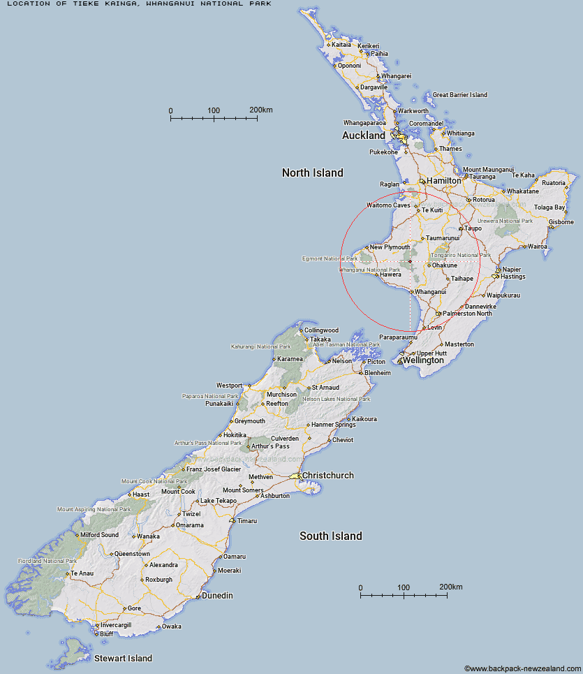
Topo Map showing location of Tieke Kainga
This information is sourced from DoC, LINZ and Openstreetmap. Some of the hut photos are mine and the rest are from DoC. I will be adding an upload feature soon so people can photos of .Tieke Kainga.
Basic info: 20-bunk hut located on the Whanganui Journey in the Whanganui region.
Latitude: -39.3375472265
Longitude: 174.993147561
Location: Whanganui National Park
Area: Manawatu/Whanganui
Type of Hut: Great Walk
Tracks: Whanganui Journey
Map: BJ32 Topo Map | Road Map
Does this hut still exist? Have any more information? Contact
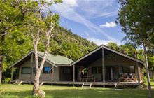
Image: DoC
Scroll down to see a topographical map and road map showing the location of Tieke Kainga
[ A ] [ B ] [ C ] [ D ] [ E ] [ F ] [ G ] [ H ] [ I ] [ J ] [ K ] [ L ] [ M ] [ N ] [ O ] [ P ] [ Q ] [ R ] [ S ] [ T ] [ U ] [ V ] [ W ] [ Y ] [ Z ]
Closest 20 Huts to Tieke Kainga
These are as the crow fliesPuketotara Hut 1.96km Ngapurua Hut 8.17km Pouri Hut 12.21km John Coull Hut 13.46km Puteore Hut 17.85km Omaru Hut 19.43km Tahupo Hut 21.59km Trains Hut 27.57km Ohuraiti Hut 31.54km Mangaturuturu Hut 43.99km Downes hut 44.83km Lupton Hut 45.5km Blyth Hut 45.75km Whakapapaiti Hut 46.49km Mangaehuehu Hut 47.9km Rerekapa Hut 50.61km Whangaehu Hut 51.6km Ten Man Hut 52.99km Rangipo Hut 54.41km Mangatepopo Hut 56.23km Old Waihohonu Hut 60.2km Waihohonu Hut 60.8km Ketetahi Shelter 62.31km Oturere Hut 63.15km Zekes Hut 68.56km Westlawn Hut 75.32km Waingongoro Hut 75.95km Maketawa Hut 77.18km Hooker Shelter 77.91km Kaiauai Shelter 78.93km Hauhungaroa Hut 79.57km Syme Hut 79.81km Lake Dive Hut 80.19km Holly Hut 81.77km Pouakai Hut 83.03km Kahui Hut 84.32km Waiaua Gorge Hut 85.11km Bob's Hut 85.19km Waipakihi Hut 86.46km Waihaha Hut 88.65km