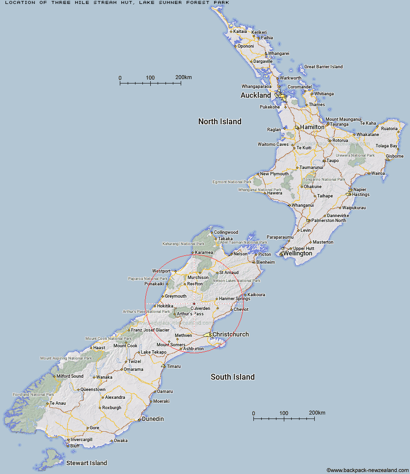
Topo Map showing location of Three Mile Stream Hut
This information is sourced from DoC, LINZ and Openstreetmap. Some of the hut photos are mine and the rest are from DoC. I will be adding an upload feature soon so people can photos of .Three Mile Stream Hut.
Basic info: standard seven-bunk hut in the North Canterbury and Arthur's Pass area.
Latitude: -42.6570354333
Longitude: 172.155587536
Location: Lake Sumner Forest Park
Area: Canterbury
Type of Hut: Standard
Tracks: Hurunui swingbridge tracks & routes
Map: BU22 Topo Map | Road Map
Does this hut still exist? Have any more information? Contact
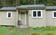
Image: DoC
Scroll down to see a topographical map and road map showing the location of Three Mile Stream Hut
[ A ] [ B ] [ C ] [ D ] [ E ] [ F ] [ G ] [ H ] [ I ] [ J ] [ K ] [ L ] [ M ] [ N ] [ O ] [ P ] [ Q ] [ R ] [ S ] [ T ] [ U ] [ V ] [ W ] [ Y ] [ Z ]
Closest 20 Huts to Three Mile Stream Hut
These are as the crow fliesLake Sumner Hut 5.66km Hurunui Hut 7.12km Mackenzie Bivouac 7.42km Top Hope Hut 7.66km Museum Hut 8.73km Saint Jacob's Hut 8.78km Lake Mason Hut 9.14km Evangeline Bivouac 10.46km Mackenzie Hut 11.25km South Branch Research Hut 11.64km Stony Stream Hut 11.92km Hope Halfway Hut 12.52km Gabriel Hut 13.09km Lake Man Bivouac 13.28km Slaty Creek Hut 13.73km Hurunui No 3 Hut 14.54km Tutaekuri Hut 15.77km Doubtless Hut 16.08km Jollie Brook Hut 16.16km Bush Camp Hut 16.89km North Esk Hut 17.42km Doubtful Hut 17.47km Camerons Hut 17.67km Upper South Branch Hurunui Hut 18.18km Mid Robinson Hut 18.47km Deep Creek Hut 19.31km Bus Shelter 19.82km Top Robinson Hut 19.98km Cold Stream Hut 20.88km Mid Trent Hut 21.66km Candlesticks Bivouac 21.95km Devils Den Bivouac 21.98km Harper Pass Bivouac 22.47km Upper Nina Bivouac 22.92km Glenrae Bivouac 23.84km Ant Stream Bivouac 23.89km Waikiti Hut 25.12km Nina Hut 25.26km Glenrae Hut 25.69km Lake Christabel Hut 25.78km