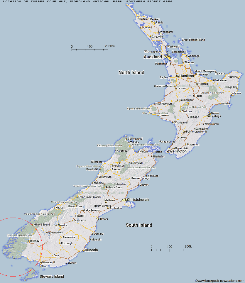
Topo Map showing location of Supper Cove Hut
This information is sourced from DoC, LINZ and Openstreetmap. Some of the hut photos are mine and the rest are from DoC. I will be adding an upload feature soon so people can photos of .Supper Cove Hut.
Basic info: standard 12-bunk hut in western Fiordland.
Latitude: -45.702230373
Longitude: 166.944579854
Location: Fiordland National Park, Southern fiords area
Area: Fiordland
Type of Hut: Standard
Tracks: Dusky Track
Map: CE05 Topo Map | Road Map
Does this hut still exist? Have any more information? Contact
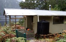
Image: DoC
Scroll down to see a topographical map and road map showing the location of Supper Cove Hut
[ A ] [ B ] [ C ] [ D ] [ E ] [ F ] [ G ] [ H ] [ I ] [ J ] [ K ] [ L ] [ M ] [ N ] [ O ] [ P ] [ Q ] [ R ] [ S ] [ T ] [ U ] [ V ] [ W ] [ Y ] [ Z ]
Closest 20 Huts to Supper Cove Hut
These are as the crow fliesSupper Cove Hut 0km Loch Maree Hut 9.6km Lake Roe Hut 15.46km Kintail Hut 16.49km Halfway Hut 16.68km Hauroko Burn Hut 21.14km Upper Spey Hut 21.75km Historic Clark Hut 30.43km West Arm Hut 31.62km Clark Hut - A Frame 31.64km Percy Shelter 32.04km Borland Bivouac 33.4km Monowai Hut 34.66km Green Lake Hut 36.54km Caroline Hut 37.36km Eel Creek Hut 38.03km North Borland Hut 42.1km Rodger Inlet Huts 42.35km Freeman Burn Hut 44.75km The Gut Hut 45.23km Hope Arm Hut 48.05km Lake Poteriteri Hut 48.22km Teal Bay Hut 48.75km Back Valley Hut 50.79km Te Oneroa Hut 51.23km Stantley Burn Hut 53.72km Slaughterburn Hut 55.29km Iris Burn Hut 55.42km Deas Cove Hut 56.66km Rocky Point Hut 56.84km Shallow Bay Hut 56.92km Moturau Hut 57.33km Okaka Lodge 58.15km Hanging Valley Shelter 58.17km Westies Hut 58.32km Forest Burn Shelter 59.96km Waitutu Hut 60.18km Luxmore Hut 63.26km Robin Saddle Hut 64.67km Wairaurahiri Hut 64.86km