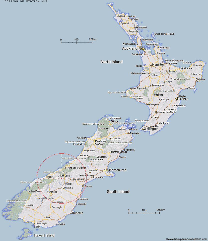
Topo Map showing location of Station Hut
This information is sourced from DoC, LINZ and Openstreetmap. Some of the hut photos are mine and the rest are from DoC. I will be adding an upload feature soon so people can photos of .Station Hut.
Latitude: -43.9690756279
Longitude: 169.959557815
Location:
Type of Hut:
Map: Topo Map | Road Map
Does this hut still exist? Have any more information? Contact
Latitude: -43.9690756279
Longitude: 169.959557815
Location:
Type of Hut:
Map: Topo Map | Road Map
Does this hut still exist? Have any more information? Contact
Scroll down to see a topographical map and road map showing the location of Station Hut
[ A ] [ B ] [ C ] [ D ] [ E ] [ F ] [ G ] [ H ] [ I ] [ J ] [ K ] [ L ] [ M ] [ N ] [ O ] [ P ] [ Q ] [ R ] [ S ] [ T ] [ U ] [ V ] [ W ] [ Y ] [ Z ]
Closest 20 Huts to Station Hut
These are as the crow fliesGrough Hut 4.1km Stony Stream Bivouac 4.78km Le Crens Hut 5.84km Dasler Bivouac 9.2km Kennedy Hut 9.9km Dodger Hut 10.37km Whale Stream Hut 10.58km Red Hut 10.59km Cullers Hut 11.15km Elcho Hut 11.17km Monument Hut 13.29km Erceg Hut 14km Waterfall Hut 15.27km Richardson Rock Bivouac 16.15km Baikie Hut 17.58km Main Huxley Forks Hut 17.79km Brodrick Hut 18.47km Reardon Hut 18.74km South Huxley Bivouac 19.45km Creswicke Flat Hut 22.26km Jollie Hut 23.1km Barron Saddle Hut 23.59km Maryburn Hut 24.02km South Temple Hut 24.71km Christmas Flat Hut 28.2km Forbes Hut 28.6km Mueller Hut 28.86km Top Hut 29.04km Harpers Rock Bivouac 29.27km Telegraph Hut 29.72km Green Point Hut 30km Lame Duck Hut 30.09km Horace Walker Hut 31.32km Stocking Stream Shelter 32.05km Maitland Hut 32.51km Sefton Bivvy 32.63km Hagens Hut 32.91km Littles Hut 35.32km Douglas Rock Hut 35.45km Cassel Flat Hut 36.14km