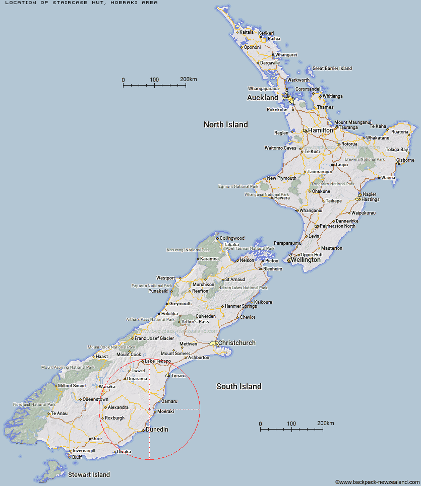
Topo Map showing location of Staircase Hut
This information is sourced from DoC, LINZ and Openstreetmap. Some of the hut photos are mine and the rest are from DoC. I will be adding an upload feature soon so people can photos of .Staircase Hut.
Basic info: basic six-bunk hut in the Coastal Otago area.
Latitude: -45.2932901967
Longitude: 170.68015622
Location: Moeraki area
Area: Otago
Type of Hut: Basic/bivvies
Map: CC17 Topo Map | Road Map
Does this hut still exist? Have any more information? Contact
Basic info: basic six-bunk hut in the Coastal Otago area.
Latitude: -45.2932901967
Longitude: 170.68015622
Location: Moeraki area
Area: Otago
Type of Hut: Basic/bivvies
Map: CC17 Topo Map | Road Map
Does this hut still exist? Have any more information? Contact
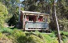
Image: DoC
Scroll down to see a topographical map and road map showing the location of Staircase Hut
[ A ] [ B ] [ C ] [ D ] [ E ] [ F ] [ G ] [ H ] [ I ] [ J ] [ K ] [ L ] [ M ] [ N ] [ O ] [ P ] [ Q ] [ R ] [ S ] [ T ] [ U ] [ V ] [ W ] [ Y ] [ Z ]
Closest 20 Huts to Staircase Hut
These are as the crow fliesRed Hut 4.64km Bog Hut 9.73km Gentle Annie Hut 13.91km Cayenne Hut 15.3km Mount Hut 16.68km Grays Hut 17.48km Mitchells Hut 18.32km Half Moon Hut 22km Middle Hut 26.74km Crumb Hut 28.31km Balmoral Huts 32.29km Bendoran Hut 45km Leaning Lodge 48.41km Philip J Cox Memorial Hut 48.64km Christmas Creek Hut 49.73km Big Hut 49.84km Jubilee Hut 50.9km Mt John Hut 51.65km Buster Hut 52.67km Possum Hut 52.92km Waitaki Huts 54.23km Brown Hut 55.58km Poplar Hut 56.15km Tailings Hut 59.6km Hut Creek Hut 60.05km Ben Rudds Hut 61.66km Howells Hut 63.7km Ida Railway Hut 64.29km Awakino Ski Field 64.31km Chimney Creek Hut 65.65km Wire Yards Hut 66.27km The Swamp Hut 72.66km Canadian Hut 73.94km Tent Hut 75.85km Pearson Hut 79.27km Otamatapaio Hut 87.78km Boundary Creek Hut 90.28km Iron Hut 93.13km Lauder Basin Hut 94.33km Top Hut 97.14km