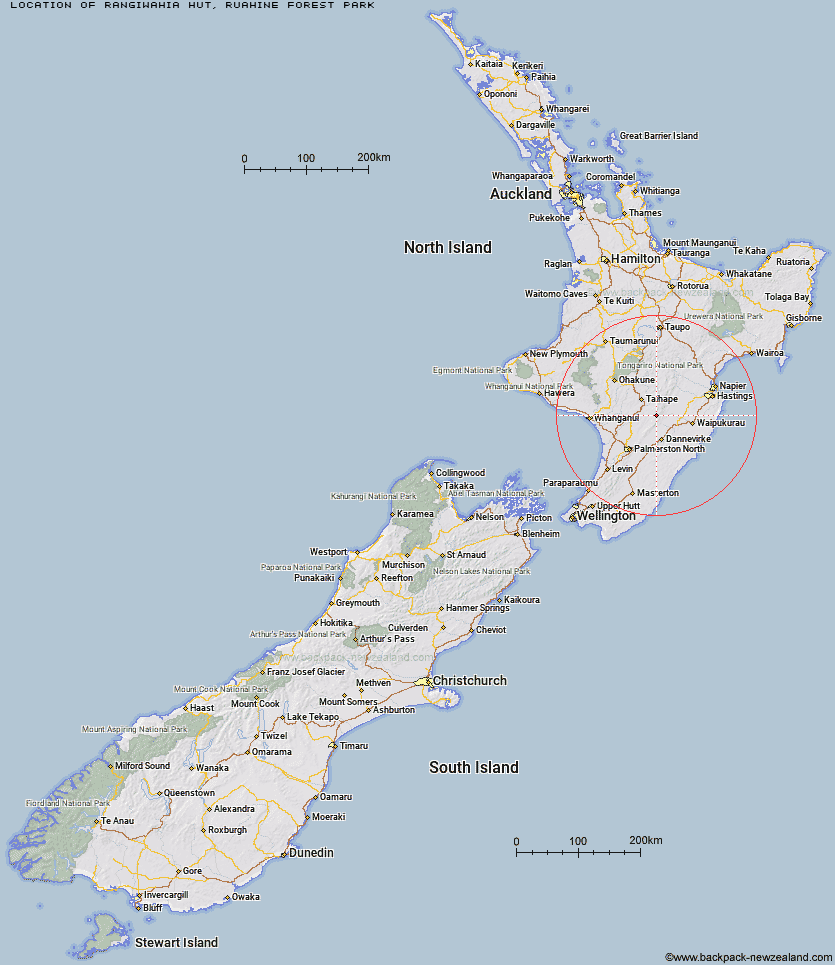
Topo Map showing location of Rangiwahia Hut
This information is sourced from DoC, LINZ and Openstreetmap. Some of the hut photos are mine and the rest are from DoC. I will be adding an upload feature soon so people can photos of .Rangiwahia Hut.
Basic info: serviced 13-bunk hut in the Manawatu region.
Latitude: -39.8908170612
Longitude: 176.018377076
Location: Ruahine Forest Park
Area: Manawatu/Whanganui
Type of Hut: Serviced
Tracks: Rangiwahia Hut Track|Rangiwahia Hut - Deadmans Track|Renfrew Roadend to Table Flat Roadend
Map: BL36 Topo Map | Road Map
Does this hut still exist? Have any more information? Contact
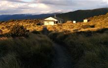
Image: DoC
Scroll down to see a topographical map and road map showing the location of Rangiwahia Hut
[ A ] [ B ] [ C ] [ D ] [ E ] [ F ] [ G ] [ H ] [ I ] [ J ] [ K ] [ L ] [ M ] [ N ] [ O ] [ P ] [ Q ] [ R ] [ S ] [ T ] [ U ] [ V ] [ W ] [ Y ] [ Z ]
Closest 20 Huts to Rangiwahia Hut
These are as the crow fliesTriangle Hut 5.11km Iron Gate Hut 5.2km Kelly Knight Hut 5.41km Pourangaki Hut 6.42km Alice Nash Memorial Heritage Lodge 7.12km Purity Hut 8.48km Howletts Hut 9.33km Waterfall Hut 10.68km Tarn Bivouac 10.76km Daphne Hut 11.03km Longview Hut 11.13km Toka Bivouac 11.26km Top Gorge Hut 11.26km Waikamaka Hut 13.22km Hinerua Hut 13.3km Leon Kinvig Hut 13.52km Awatere Hut 13.58km Smiths Stream Hut 13.78km McKinnon Hut 13.78km Kawhatau Base 14.67km Crow Hut 14.91km Makaretu Hut 15.03km Happy Daze Hut 15.81km Ngamoko Hut 16.34km Piripiri Hut 16.5km Waipawa Forks Hut 16.85km Sunrise Hut 17.18km Top Maropea Hut 17.6km Wakelings Hut 17.88km Mid Pohangina Hut 18.28km Triplex Hut 18.79km Cattle Creek Hut 19.85km Maropea Forks Hut 20.64km Gold Creek Hut 20.95km Otukota Hut 21.6km Sparrowhawk Bivouac 21.85km Stanfield Hut 22.08km Norris Hut 23.19km Diggers Hut 23.96km Traverse (A Frame) Hut 24.06km