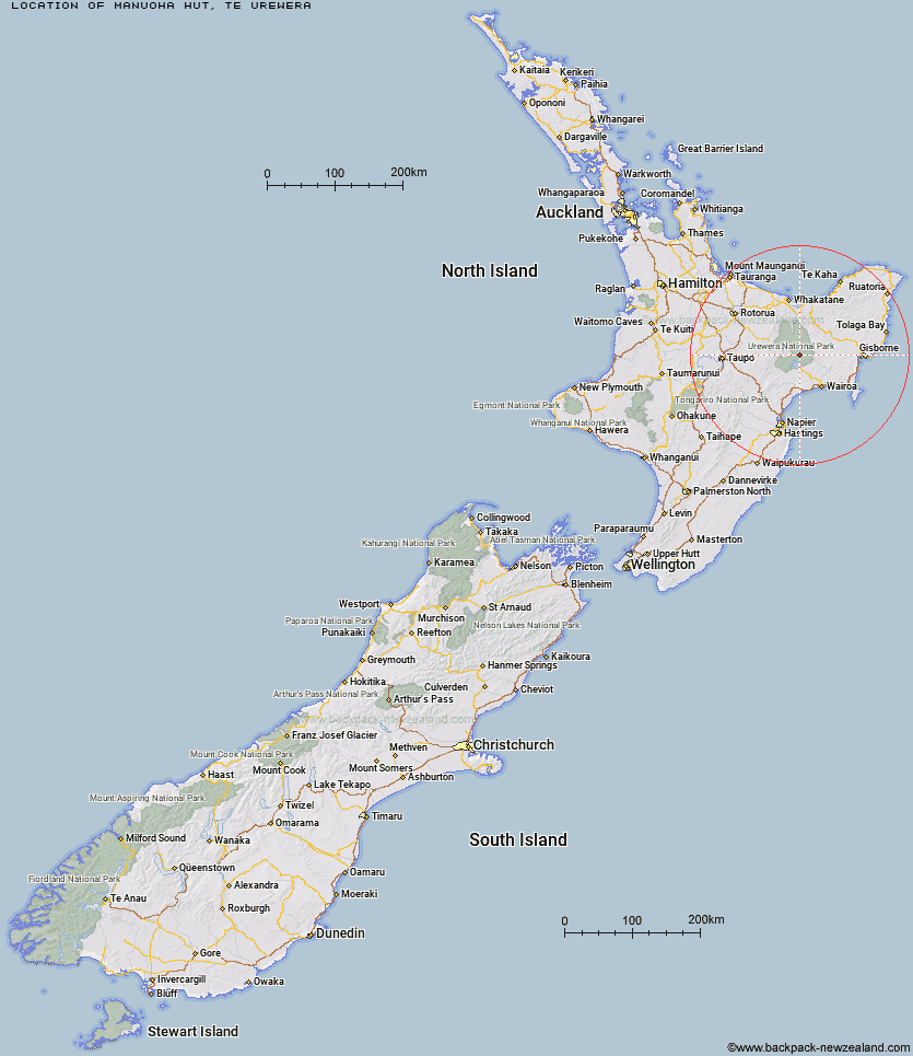
Topo Map showing location of Manuoha Hut
This information is sourced from DoC, LINZ and Openstreetmap. Some of the hut photos are mine and the rest are from DoC. I will be adding an upload feature soon so people can photos of .Manuoha Hut.
Basic info: six-bunk standard hut in the Te Urewera area.
Latitude: -38.6560813173
Longitude: 177.120771033
Location: Te Urewera
Area: East Coast
Type of Hut: Standard
Tracks: Manuoha to Waikareiti Track
Map: BG40 Topo Map | Road Map
Does this hut still exist? Have any more information? Contact
Basic info: six-bunk standard hut in the Te Urewera area.
Latitude: -38.6560813173
Longitude: 177.120771033
Location: Te Urewera
Area: East Coast
Type of Hut: Standard
Tracks: Manuoha to Waikareiti Track
Map: BG40 Topo Map | Road Map
Does this hut still exist? Have any more information? Contact
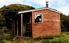
Image: DoC
Scroll down to see a topographical map and road map showing the location of Manuoha Hut
[ A ] [ B ] [ C ] [ D ] [ E ] [ F ] [ G ] [ H ] [ I ] [ J ] [ K ] [ L ] [ M ] [ N ] [ O ] [ P ] [ Q ] [ R ] [ S ] [ T ] [ U ] [ V ] [ W ] [ Y ] [ Z ]
Closest 20 Huts to Manuoha Hut
These are as the crow fliesSandy Bay Hut 7.72km Whanganui Hut 10.04km Kanohirua Hut 10.33km Whakatakaa Hut 11.12km Waiawa Hut 11.96km Waiharuru Hut 12.38km Makomako Hut 13.34km Mangatoatoa Hut 14.82km Taurawharona Hut 15.89km Marauiti Hut 16.47km Te Rangaakapua Hut 16.65km Panekire Hut 18.39km Otanetea Hut 19.31km Tawhiwhi Hut 19.64km Waiopaoa Hut 20.25km Te Pua Hut 21km Te Panaa Hut 21.89km Takurua Hut 21.89km Ngahiramai Hut 22.05km Makakoere Hut 22.69km Te Totara Hut 23.01km Tataweka Hut 23.64km Kahunui Hut 23.85km Otane Hut 24.03km Te Pourewa Hut 26.19km Central Waiau Hut 26.83km Tawa Hut 27.63km Mangapouri Hut 28.43km Te Waiotukapiti Hut 28.65km Skips Hut (Whangatawhia) 28.74km Hanamahihi Hut 28.82km Otapukawa Hut 29.42km Ohane Hut 29.54km Rogers Hut (Te Wairoa) 30.71km Waikare Junction Hut 31.2km Koranga Forks Hut 32.23km Okui Hut 32.28km Manaohou Right Branch Hut 32.29km Mangakahika Hut 34.52km Koaunui Hut 35.24km