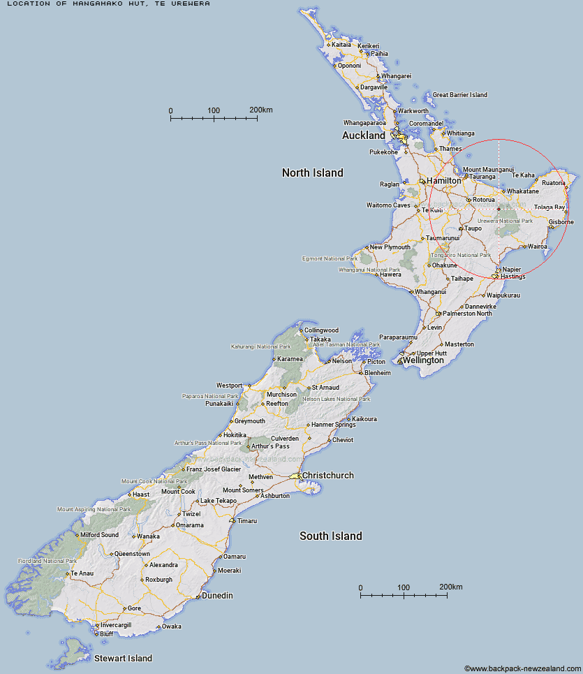
Topo Map showing location of Mangamako Hut
This information is sourced from DoC, LINZ and Openstreetmap. Some of the hut photos are mine and the rest are from DoC. I will be adding an upload feature soon so people can photos of .Mangamako Hut.
Basic info: standard six-bunk hut in the Te Urewera area.
Latitude: -38.3130851667
Longitude: 176.875042186
Location: Te Urewera
Area: East Coast
Type of Hut: Standard
Map: BG40 Topo Map | Road Map
Does this hut still exist? Have any more information? Contact
Basic info: standard six-bunk hut in the Te Urewera area.
Latitude: -38.3130851667
Longitude: 176.875042186
Location: Te Urewera
Area: East Coast
Type of Hut: Standard
Map: BG40 Topo Map | Road Map
Does this hut still exist? Have any more information? Contact
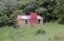
Image: DoC
Scroll down to see a topographical map and road map showing the location of Mangamako Hut
[ A ] [ B ] [ C ] [ D ] [ E ] [ F ] [ G ] [ H ] [ I ] [ J ] [ K ] [ L ] [ M ] [ N ] [ O ] [ P ] [ Q ] [ R ] [ S ] [ T ] [ U ] [ V ] [ W ] [ Y ] [ Z ]
Closest 20 Huts to Mangamako Hut
These are as the crow fliesCasino Hut 2.94km Waihua Hut 4.14km Duckville Hut 5.52km Saddle (Mangaawai) Hut 7.09km Apiti Hut 8.62km Twain (Waipotiki) Hut 9.69km Horomanga Base Camp 11.6km Manaohou Right Branch Hut 11.72km Ohora Hut 12.47km Waikare Junction Hut 14.12km Hanamahihi Hut 14.91km Wharekahika Hut 15.64km Onepu Hut 16.6km Ohane Hut 16.83km Ngahiramai Hut 21.85km Takurua Hut 21.87km Te Pourewa Hut 23.62km Tawhiwhi Hut 24.29km Okui Hut 24.89km Mangapouri Hut 25.11km Otanetea Hut 25.13km Otapukawa Hut 25.47km Te Panaa Hut 25.52km Koaunui Hut 26.77km Te Pua Hut 28.45km Taurawharona Hut 29.28km Otane Hut 29.66km Waiawa Hut 31.79km Makomako Hut 33.23km Tataweka Hut 34km Kanohirua Hut 34.68km Mangatoatoa Hut 34.91km Tawa Hut 36.36km Nikau Flat Hut 36.53km Te Rangaakapua Hut 36.85km Koranga Forks Hut 37.17km Makakoere Hut 37.39km Kotepato Hut 39.54km Kahunui Hut 39.62km Wairua Hut 40.26km