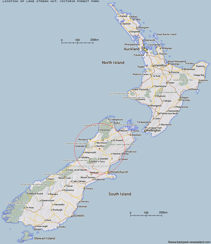
Topo Map showing location of Lake Stream Hut
This information is sourced from DoC, LINZ and Openstreetmap. Some of the hut photos are mine and the rest are from DoC. I will be adding an upload feature soon so people can photos of .Lake Stream Hut.
Basic info: basic two-bunk hut in the Greymouth area.
Latitude: -42.2477115961
Longitude: 172.132137285
Location: Victoria Forest Park
Area: West Coast
Type of Hut: Basic/bivvies
Tracks: Rahu Saddle Tracks - Reefton
Map: BT22 Topo Map | Road Map
Does this hut still exist? Have any more information? Contact
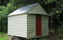
Image: DoC
Scroll down to see a topographical map and road map showing the location of Lake Stream Hut
[ A ] [ B ] [ C ] [ D ] [ E ] [ F ] [ G ] [ H ] [ I ] [ J ] [ K ] [ L ] [ M ] [ N ] [ O ] [ P ] [ Q ] [ R ] [ S ] [ T ] [ U ] [ V ] [ W ] [ Y ] [ Z ]
Closest 20 Huts to Lake Stream Hut
These are as the crow fliesTop Waitahu Bivouac 5.21km Manson-Nicholls Memorial Hut 14.43km Montgomerie Hut 15.56km Kirwans Hut 18.97km Pell Stream Hut 18.98km Wheel Creek Hut 19.66km Big River Hut 19.7km Lake Christabel Hut 23.37km Brass Monkey Bivouac 24.35km Top Robinson Hut 25.92km Cannibal Gorge Hut 26.03km Lucretia Hut 26.73km Upper Nina Bivouac 27.22km Ada Pass Hut 27.49km Burn Creek Hut 28.01km Mid Robinson Hut 28.27km Nina Hut 28.84km Bobs Hut 29.27km Nardoo Hut 29.75km Devils Den Bivouac 29.84km Doubtless Hut 31.47km Slaty Creek Hut 33.3km Anne Cullers Hut 33.79km Doubtful Hut 33.87km Rokeby Hut 34.2km Lake Man Bivouac 34.37km Anne Hut 34.6km Downie Hut 34.76km Christopher Cullers Hut 35.25km East Matakitaki Hut 35.57km Christopher Hut 35.91km Boyle Flat Hut 36.27km Top Hope Hut 38.2km Jim's Flat Hut 39.01km Magdalen Hut 39.53km Saint Jacob's Hut 40.63km Matakitaki Base Hut 41.07km Jervois Hut 41.13km Upper D'Urville Hut 41.98km Bus Shelter 42.6km