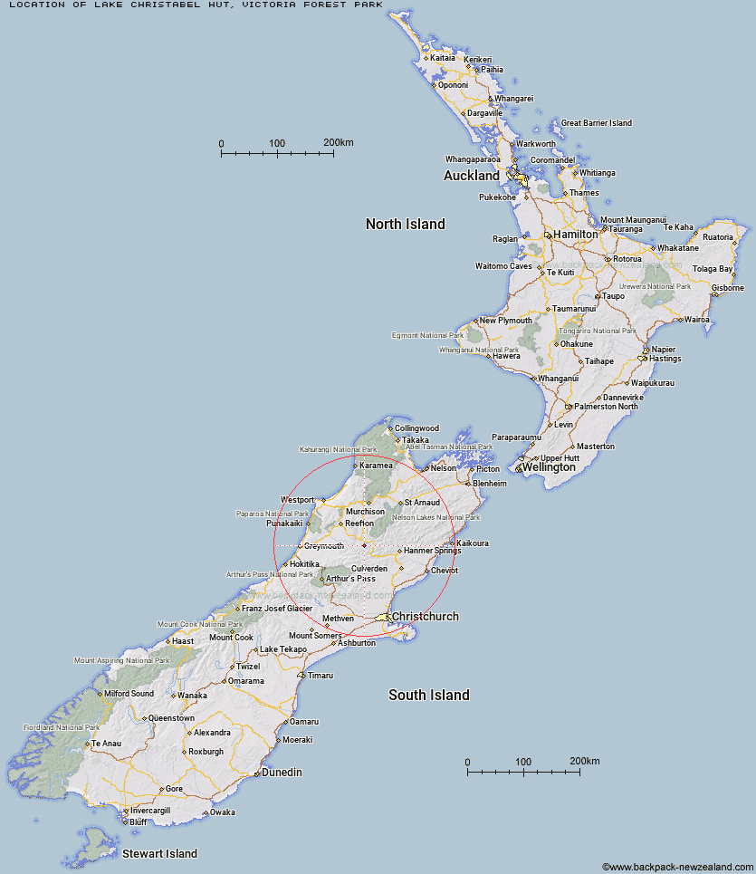
Topo Map showing location of Lake Christabel Hut
This information is sourced from DoC, LINZ and Openstreetmap. Some of the hut photos are mine and the rest are from DoC. I will be adding an upload feature soon so people can photos of .Lake Christabel Hut.
Basic info: standard eight-bunk hut in the Greymouth area.
Latitude: -42.4371423717
Longitude: 172.255256799
Location: Victoria Forest Park
Area: West Coast
Type of Hut: Standard
Tracks: Lake Christabel tracks
Map: BT22 Topo Map | Road Map
Does this hut still exist? Have any more information? Contact
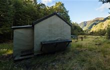
Image: DoC
Scroll down to see a topographical map and road map showing the location of Lake Christabel Hut
[ A ] [ B ] [ C ] [ D ] [ E ] [ F ] [ G ] [ H ] [ I ] [ J ] [ K ] [ L ] [ M ] [ N ] [ O ] [ P ] [ Q ] [ R ] [ S ] [ T ] [ U ] [ V ] [ W ] [ Y ] [ Z ]
Closest 20 Huts to Lake Christabel Hut
These are as the crow fliesUpper Nina Bivouac 3.86km Brass Monkey Bivouac 5.36km Nina Hut 6.35km Devils Den Bivouac 6.48km Top Robinson Hut 7.72km Lucretia Hut 7.74km Doubtless Hut 9.74km Doubtful Hut 10.7km Lake Man Bivouac 12.69km Pell Stream Hut 14.21km Manson-Nicholls Memorial Hut 14.97km Mid Robinson Hut 15.65km Rokeby Hut 17.1km Boyle Flat Hut 17.14km Top Hope Hut 18.19km Slaty Creek Hut 18.43km Saint Jacob's Hut 18.72km Cannibal Gorge Hut 18.89km Magdalen Hut 19.21km Bus Shelter 19.28km Hope Halfway Hut 20.17km Museum Hut 21.52km Ada Pass Hut 22.2km Anne Cullers Hut 23.29km Lake Stream Hut 23.37km Carlyle Hut 23.39km Anne Hut 24.43km Steyning Hut 25.09km Three Mile Stream Hut 25.78km Tin Jug Hut 26.37km Jervois Hut 26.61km Evangeline Bivouac 27.34km Mackenzie Bivouac 28.16km Top Waitahu Bivouac 28.57km Pool Hut 29.93km Old Bridge Hut 30.11km Christopher Cullers Hut 30.18km Christopher Hut 30.35km Bobs Hut 30.39km Tutaekuri Hut 30.45km