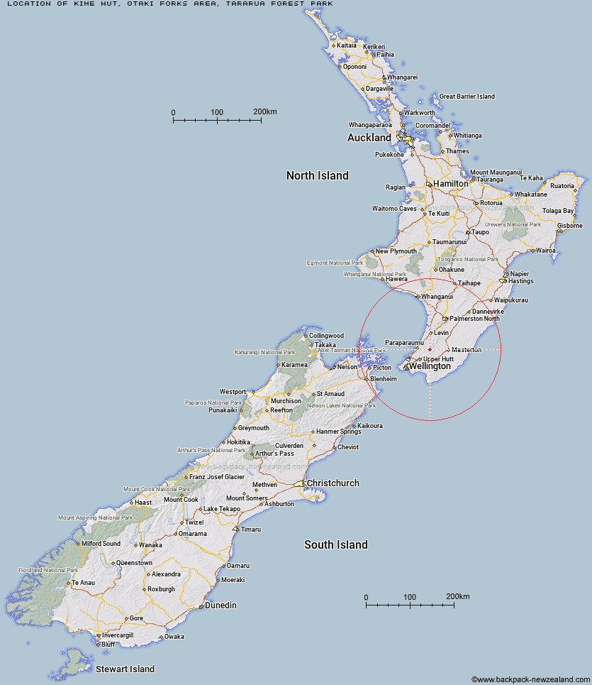
Topo Map showing location of Kime Hut
This information is sourced from DoC, LINZ and Openstreetmap. Some of the hut photos are mine and the rest are from DoC. I will be adding an upload feature soon so people can photos of .Kime Hut.
Basic info: Kime is a standard 20 bunk hut on the Southern Crossing.
Latitude: -40.9428443653
Longitude: 175.271727981
Location: Otaki Forks area, Tararua Forest Park
Area: Wellington/Kapiti
Type of Hut: Standard
Tracks: Tararua Southern Crossing
Map: BP33 Topo Map | Road Map
Does this hut still exist? Have any more information? Contact
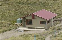
Image: DoC
Scroll down to see a topographical map and road map showing the location of Kime Hut
[ A ] [ B ] [ C ] [ D ] [ E ] [ F ] [ G ] [ H ] [ I ] [ J ] [ K ] [ L ] [ M ] [ N ] [ O ] [ P ] [ Q ] [ R ] [ S ] [ T ] [ U ] [ V ] [ W ] [ Y ] [ Z ]
Closest 20 Huts to Kime Hut
These are as the crow fliesField Hut 4.11km Elder Hut 4.62km Penn Creek Hut 4.75km Alpha Hut 4.85km Maungahuka Hut 6.24km Neill Forks Hut 7.17km Waiotauru Hut 7.28km Cone Hut 7.88km Eastern Hutt Hut 8.17km Tutuwai Hut 8.72km Renata Hut 8.79km Aokaparangi Hut 9.36km Kapakapanui Hut 10.18km Sayer Hut 10.29km Totara Flats Hut 11.1km Mid Waiohine Hut 11.99km Waiohine Shelter 12.34km Smith Creek Shelter 12.39km Waitewaewae Hut 12.77km Anderson Memorial Hut 12.85km Powell Hut 14.34km Mountain House Shelter 14.47km McGregor Bivouac 16.94km Nichols Hut 17.15km Jumbo Hut 17.22km Atiwhakatu Hut 17.43km Mid King Bivouac 19.63km Dorset Ridge Hut 19.67km Carkeek Hut 19.94km Mitre Flats Hut 21.42km Dracophyllum Hut 21.65km Tarn Ridge Hut 21.83km Waikawa Shelter 24.77km Arete Forks Hut 25.09km Waiopehu Hut 25.12km Te Matawai Hut 25.2km Arete Hut 25.69km Cow Creek Hut 26.1km Blue Range Hut 26.6km South Ohau Hut 26.9km