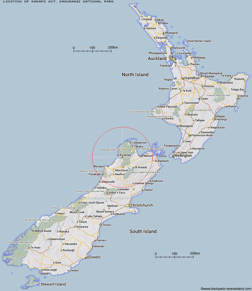
Topo Map showing location of Kākāpō Hut
This information is sourced from DoC, LINZ and Openstreetmap. Some of the hut photos are mine and the rest are from DoC. I will be adding an upload feature soon so people can photos of .Kākāpō Hut.
Basic info: basic four-bunk hut in the Buller area.
Latitude: -41.3324724712
Longitude: 172.303624007
Location: Kahurangi National Park
Area: West Coast
Type of Hut: Basic/bivvies
Map: BQ23 Topo Map | Road Map
Does this hut still exist? Have any more information? Contact
Basic info: basic four-bunk hut in the Buller area.
Latitude: -41.3324724712
Longitude: 172.303624007
Location: Kahurangi National Park
Area: West Coast
Type of Hut: Basic/bivvies
Map: BQ23 Topo Map | Road Map
Does this hut still exist? Have any more information? Contact
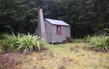
Image: DoC
Scroll down to see a topographical map and road map showing the location of Kākāpō Hut
[ A ] [ B ] [ C ] [ D ] [ E ] [ F ] [ G ] [ H ] [ I ] [ J ] [ K ] [ L ] [ M ] [ N ] [ O ] [ P ] [ Q ] [ R ] [ S ] [ T ] [ U ] [ V ] [ W ] [ Y ] [ Z ]
Closest 20 Huts to Kākāpō Hut
These are as the crow fliesKākāpō Hut 0km Wangapeka Bivouac 5.71km Belltown Manunui Hut 5.89km Stag Flat Shelter 7.14km Taipo Hut 7.33km Trevor Carter Hut 10.27km Helicopter Flat Hut 10.45km Greys Hut 10.64km Thor Hut 11.43km Venus Hut 11.48km Crow Hut 14.46km Stone Hut 14.98km Johnson Hut 15.18km Adams Flat Hut 16.83km Kiwi Saddle Hut 17.96km Roaring Lion Hut 18.49km Sunshine Flat Shelter 19.76km Hurricane Hut 20.47km Karamea Bend Hut 20.55km Kings Creek Hut 20.93km Cecil Kings Hut 20.94km John Reid Hut 21.94km Flanagans Hut 24.95km Larrikin Creek Hut 25.31km Mokihinui Forks Hut 26.15km Specimen Point Hut 26.76km Branch Creek Hut 27.41km McConchies Hut 28.8km Splugeons Rock Shelter 29.15km Kohaihai Shelter 29.98km Granity Pass Hut 30.16km Poor Pete's Hut 31.35km Goat Creek Hut 31.63km Balloon Hut 32.26km Ellis Hut 33.62km Trilobite Hut 34.04km Dry Rock Shelter 34.42km Myttons Hut 34.43km Chaffey Hut 34.61km Tent Camp 35.45km