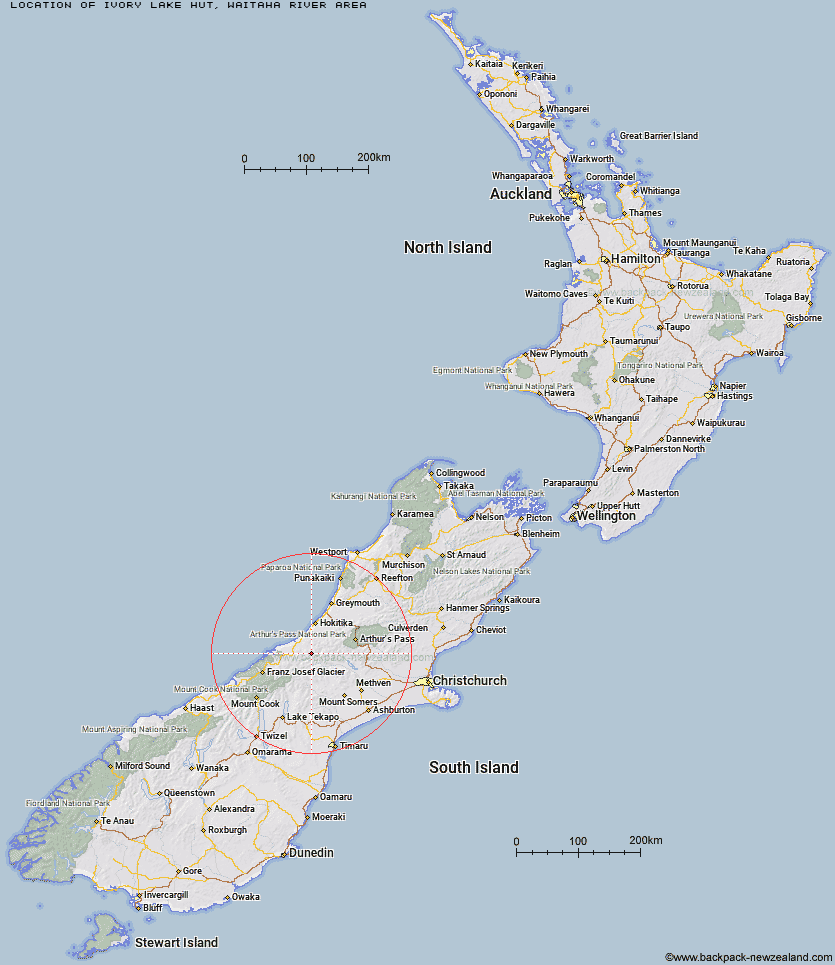
Topo Map showing location of Ivory Lake Hut
This information is sourced from DoC, LINZ and Openstreetmap. Some of the hut photos are mine and the rest are from DoC. I will be adding an upload feature soon so people can photos of .Ivory Lake Hut.
Basic info: basic six-bunk hut in the Hokitika area.
Latitude: -43.1353572315
Longitude: 170.913269698
Location: Waitaha River area
Area: West Coast
Type of Hut: Basic/bivvies
Map: BW18 Topo Map | Road Map
Does this hut still exist? Have any more information? Contact
Basic info: basic six-bunk hut in the Hokitika area.
Latitude: -43.1353572315
Longitude: 170.913269698
Location: Waitaha River area
Area: West Coast
Type of Hut: Basic/bivvies
Map: BW18 Topo Map | Road Map
Does this hut still exist? Have any more information? Contact
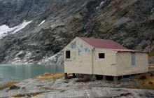
Image: DoC
Scroll down to see a topographical map and road map showing the location of Ivory Lake Hut
[ A ] [ B ] [ C ] [ D ] [ E ] [ F ] [ G ] [ H ] [ I ] [ J ] [ K ] [ L ] [ M ] [ N ] [ O ] [ P ] [ Q ] [ R ] [ S ] [ T ] [ U ] [ V ] [ W ] [ Y ] [ Z ]
Closest 20 Huts to Ivory Lake Hut
These are as the crow fliesIvory Lake Hut 0km Top Waitaha Hut 3.02km Price Basin Hut 4.12km Top Tuke Hut 5.44km County Stream Hut 5.74km Wilkinson Hut 6.65km Neave Hut 7.54km Price Flat Hut 8.09km Price Flat Hut 8.14km Moonbeam Hut 8.58km Dickie Spur Hut 9.21km Healey Creek Hut 9.47km Smyth Hut 9.71km Polluck Creek Hut 10.92km Mikonui Spur Bivouac 11.94km Mikonui Flat Hut 12.84km Kiwi Flat Hut 13.54km Frew Hut 14.24km Scamper Torrent Hut 14.41km West Mathias Bivouac 14.72km Explorer Hut 14.76km Lauper Bivouac 15.4km Frew Saddle Bivouac 15.88km Rapid Creek Hut 15.91km Hunters Hut 16.55km Reischek Hut 16.58km Evans Hut 16.79km Washbourne Hut 17.88km Centennial Cabin 17.9km Lyell Hut 18.21km Black Hut 18.53km Mathias Hut 18.6km Serpentine Hut 19.12km Moraine Hut 19.21km Frisco Hut 19.76km Canyon Creek Bivouac 19.83km Bluff Hut 19.95km Sir Robert Hut 21.42km Banfield Hut 21.51km Poet Hut 22.34km