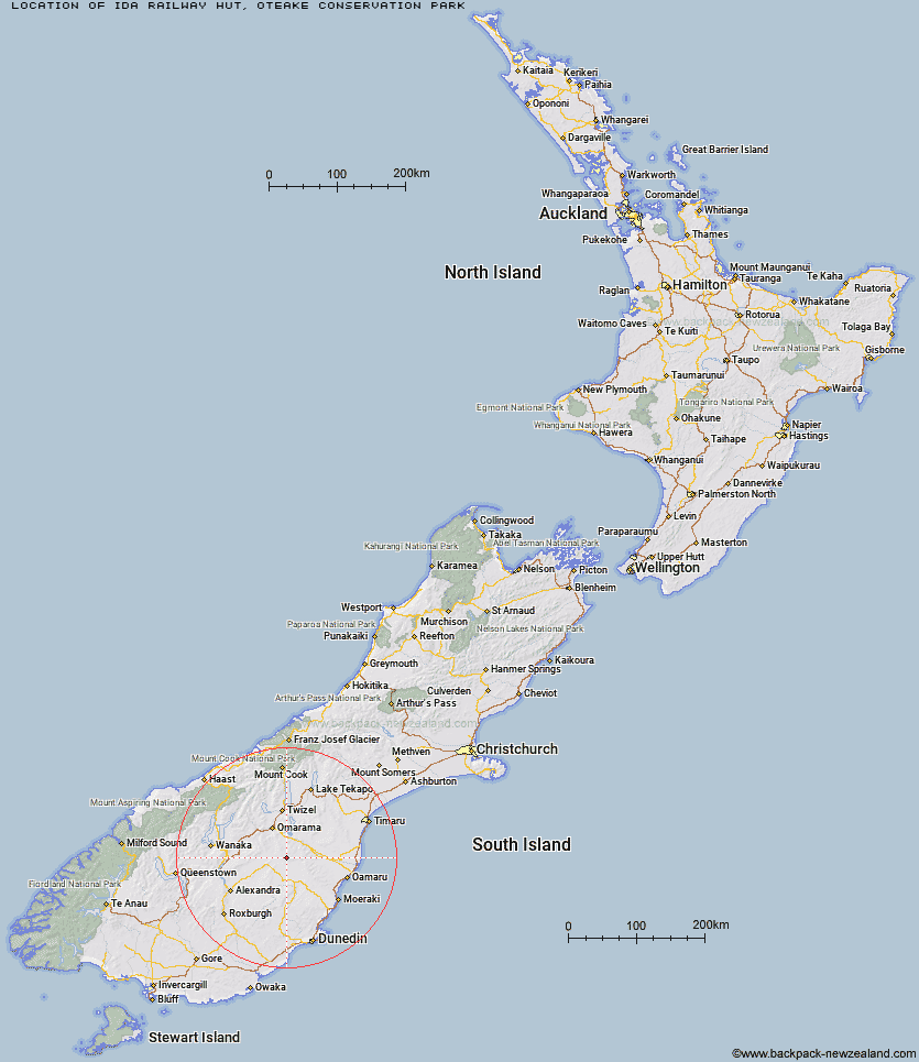
Topo Map showing location of Ida Railway Hut
This information is sourced from DoC, LINZ and Openstreetmap. Some of the hut photos are mine and the rest are from DoC. I will be adding an upload feature soon so people can photos of .Ida Railway Hut.
Basic info: Ida Railway Hut is a 12-bunk hut in the Central Otago area.
Latitude: -44.8480443916
Longitude: 170.157791143
Location: Oteake Conservation Park
Area: Otago
Type of Hut: Standard
Map: CB15 Topo Map | Road Map
Does this hut still exist? Have any more information? Contact
Basic info: Ida Railway Hut is a 12-bunk hut in the Central Otago area.
Latitude: -44.8480443916
Longitude: 170.157791143
Location: Oteake Conservation Park
Area: Otago
Type of Hut: Standard
Map: CB15 Topo Map | Road Map
Does this hut still exist? Have any more information? Contact
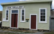
Image: DoC
Scroll down to see a topographical map and road map showing the location of Ida Railway Hut
[ A ] [ B ] [ C ] [ D ] [ E ] [ F ] [ G ] [ H ] [ I ] [ J ] [ K ] [ L ] [ M ] [ N ] [ O ] [ P ] [ Q ] [ R ] [ S ] [ T ] [ U ] [ V ] [ W ] [ Y ] [ Z ]
Closest 20 Huts to Ida Railway Hut
These are as the crow fliesWire Yards Hut 3.23km Chimney Creek Hut 4.38km Tailings Hut 6.65km Brown Hut 9.56km Hut Creek Hut 9.74km Buster Hut 11.7km Awakino Ski Field 14.24km Otamatapaio Hut 23.56km Boundary Creek Hut 27.34km Top Hut 33.67km Pearson Hut 34.68km Balmoral Huts 35.67km Crumb Hut 35.99km Richmond Hut 38.6km Middle Hut 38.93km Lauder Basin Hut 39.25km Half Moon Hut 42.29km Mitchells Hut 46.03km Grays Hut 46.84km Polson's Hut 46.9km Cayenne Hut 49.11km Mount Hut 49.14km Gentle Annie Hut 50.83km Bog Hut 55.11km Red Hut 59.94km Burnt Bush Hut 61.71km Leaning Lodge 63.76km Staircase Hut 64.29km Big Hut 65.68km Stodys Hut 66.34km Top Timaru Hut 66.77km Hideaway Hut 67.4km Pakituhi Hut 69.89km Mae West Bivouac 70.07km Moonlight & Roses Hut 71.69km Junction Hut 72.03km Snowy Gorge Hut 72.64km Bush Hut 73.6km Cotters Hut 74.08km Ben Avon Hut 75.29km