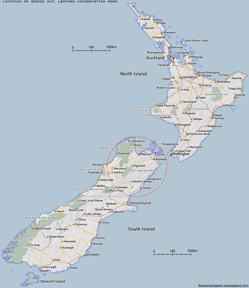
Topo Map showing location of Greigs Hut
This information is sourced from DoC, LINZ and Openstreetmap. Some of the hut photos are mine and the rest are from DoC. I will be adding an upload feature soon so people can photos of .Greigs Hut.
Basic info: standard 15-bunk hut in the South Marlborough area.
Latitude: -41.8366282879
Longitude: 173.105209873
Location: Leatham Conservation Area
Area: Marlborough
Type of Hut: Standard
Map: BS25 Topo Map | Road Map
Does this hut still exist? Have any more information? Contact
Basic info: standard 15-bunk hut in the South Marlborough area.
Latitude: -41.8366282879
Longitude: 173.105209873
Location: Leatham Conservation Area
Area: Marlborough
Type of Hut: Standard
Map: BS25 Topo Map | Road Map
Does this hut still exist? Have any more information? Contact
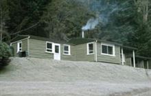
Image: DoC
Scroll down to see a topographical map and road map showing the location of Greigs Hut
[ A ] [ B ] [ C ] [ D ] [ E ] [ F ] [ G ] [ H ] [ I ] [ J ] [ K ] [ L ] [ M ] [ N ] [ O ] [ P ] [ Q ] [ R ] [ S ] [ T ] [ U ] [ V ] [ W ] [ Y ] [ Z ]
Closest 20 Huts to Greigs Hut
These are as the crow fliesMid Silverstream Hut 4.91km Siberia Hut 5.37km Barbers Hut 6.07km Silverstream Bivouac 7.07km Lost Stream Bivouac 7.4km Caves Hut 7.79km Bull Paddock Creek Hut 9.05km Bottom Misery Hut 9.5km Bottom Gordons Hut 10.44km Top Misery Hut 10.6km Top Gordon Hut 12.94km Boulder Forks Hut 13.4km Red Hills Hut 15.04km Branch Bivouac 15.21km Top Leatham Hut 15.3km Lees Creek Hut 16.04km Blue Mountain Hut 18.35km Hidden Hut 19.13km Beebys Hut 19.46km Turkeys Nest Bivouac 20.53km Gosling Hut 21.06km Team Hut 21.15km Burnt Yards Hut 21.48km Porters Creek Hut 22.23km Bushline Hut 23.36km Junction Hut 23.43km Munroe Hut 23.59km Lakehead Hut 23.85km Coldwater Hut 24.16km Bushedge Shelter 24.4km Relax Shelter 24.53km Saxton Hut 24.64km Top Wairoa Hut 25.23km Lower Goulter Hut 25.59km Severn Hut 25.68km Connors Creek Hut 26.15km Carters Yards Hut 26.72km Top Whare 26.8km Hunters Hut 27.69km Speargrass Hut 29.28km