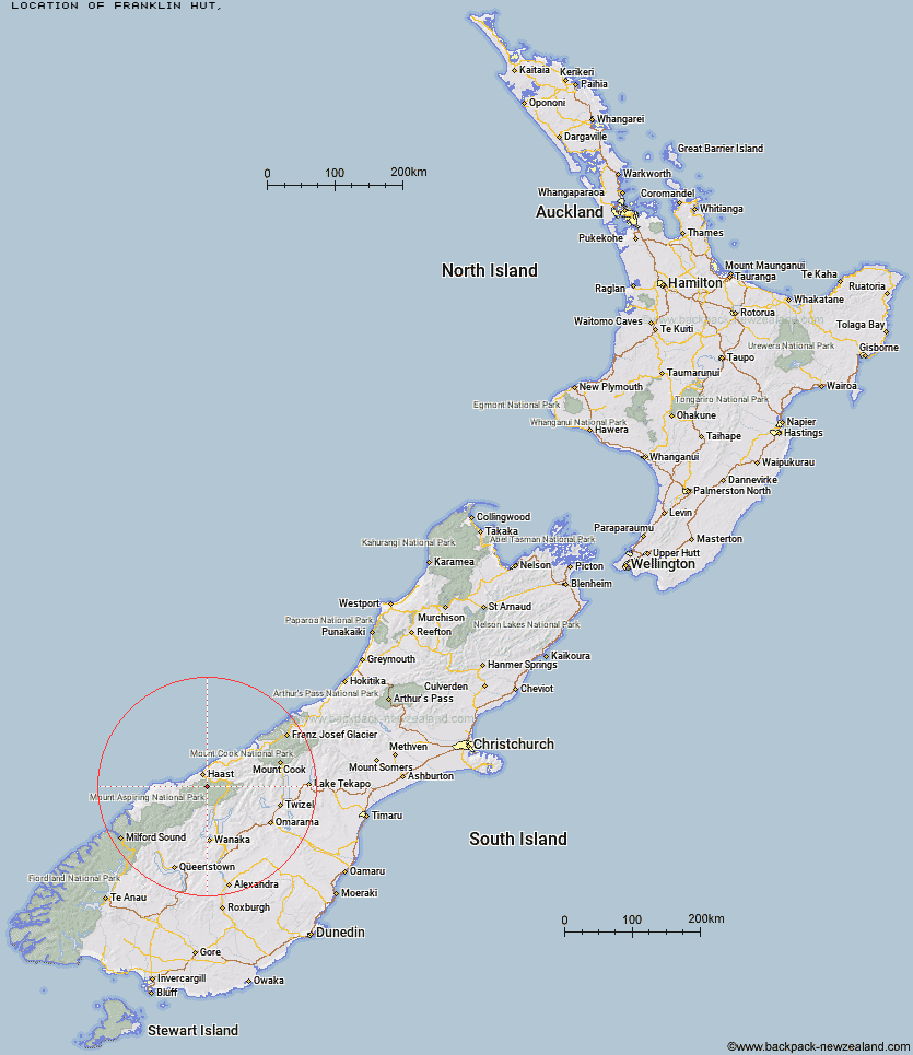
Topo Map showing location of Franklin Hut
This information is sourced from DoC, LINZ and Openstreetmap. Some of the hut photos are mine and the rest are from DoC. I will be adding an upload feature soon so people can photos of .Franklin Hut.
Latitude: -44.028916966
Longitude: 169.094797405
Location:
Type of Hut:
Map: Topo Map | Road Map
Does this hut still exist? Have any more information? Contact
Latitude: -44.028916966
Longitude: 169.094797405
Location:
Type of Hut:
Map: Topo Map | Road Map
Does this hut still exist? Have any more information? Contact
Scroll down to see a topographical map and road map showing the location of Franklin Hut
[ A ] [ B ] [ C ] [ D ] [ E ] [ F ] [ G ] [ H ] [ I ] [ J ] [ K ] [ L ] [ M ] [ N ] [ O ] [ P ] [ Q ] [ R ] [ S ] [ T ] [ U ] [ V ] [ W ] [ Y ] [ Z ]
Closest 20 Huts to Franklin Hut
These are as the crow fliesFranklin Hut 0km Red Hut 12.81km Young Hut 16.21km Thomas River Hut 17.04km Siberia Hut 19.73km Roaring Billy Hut 23.54km Coppermine Creek Hut 23.7km Kerin Forks Hut 23.85km Cameron Hut 25.88km Brewster Hut 26.2km Maori Saddle Hut 27.86km Wills Hut 29.35km Makarora Hut 29.78km Top Forks Hut 31.76km Blue River (Blowfly) Hut 33.08km Craigie Burn Hut 33.09km Albert Burn Hut 35.12km Horseshoe Flat Hut 35.34km Big Hopwood Burn Hut 35.52km Middle Head Hut 36.78km Scrubby Hut 37.29km Ferguson Hut 37.77km Boundary Hut 37.89km Little Boundary Hut 38.05km Bull Flat Hut 38.19km Green Bush Hut 39.37km High Burn Hut 40.03km Forbes Hut 42.01km Tunnel Creek Hut 42.45km Stafford Hut 44.11km Sawyer Burn Hut 44.92km Hagens Hut 45.73km Top Dingle Hut 46.24km Shamrock Hut 46.58km Top Hut 46.72km Ahuriri Base Hut 48.48km Rock of Ages Bivouac 48.8km Creswicke Flat Hut 48.98km Ben Avon Hut 48.99km Colin Todd Hut 49.74km